Earth
Bildnummer 11735166
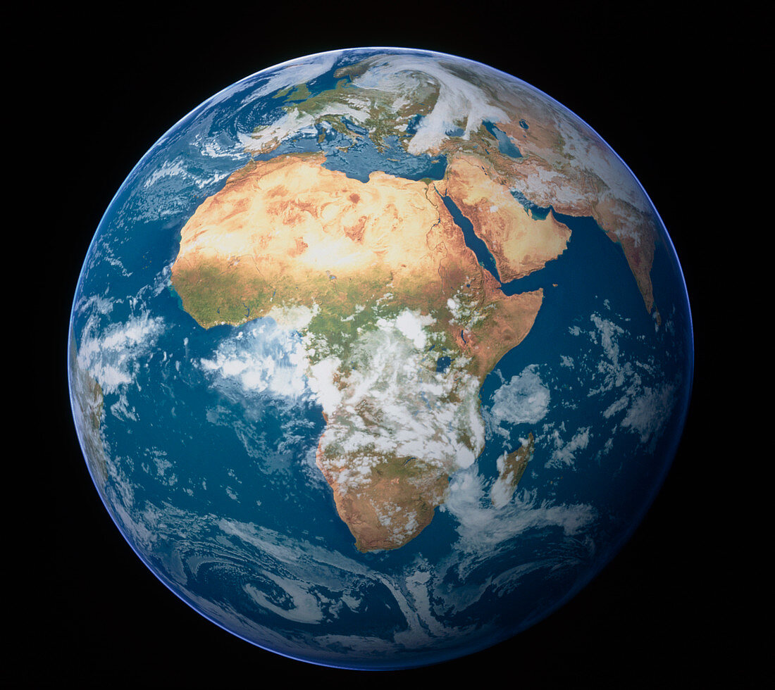
| Earth. Satellite image of the Earth,centred on Africa. North is at top. Water is blue,vegetation is green,arid areas are brown and clouds are white. Africa displays a wide range of climates,from the deserts (brown) of the north,to the forests and grassy plains (green) of the western coasts and the central regions. It is surrounded by the Atlantic Ocean (upper left to lower left),the Indian Ocean (lower right),Asia (upper right) and Europe (top centre). Europe is separated from Africa by the Mediterranean Sea (upper centre). The island of Madagascar (lower right) is also seen | |
| Lizenzart: | Lizenzpflichtig |
| Credit: | Science Photo Library / Planetary Visions |
| Bildgröße: | 4843 px × 4313 px |
| Modell-Rechte: | nicht erforderlich |
| Eigentums-Rechte: | nicht erforderlich |
| Restrictions: | - |
Preise für dieses Bild ab 15 €
Universitäten & Organisationen
(Informationsmaterial Digital, Informationsmaterial Print, Lehrmaterial Digital etc.)
ab 15 €
Redaktionell
(Bücher, Bücher: Sach- und Fachliteratur, Digitale Medien (redaktionell) etc.)
ab 30 €
Werbung
(Anzeigen, Aussenwerbung, Digitale Medien, Fernsehwerbung, Karten, Werbemittel, Zeitschriften etc.)
ab 55 €
Handelsprodukte
(bedruckte Textilie, Kalender, Postkarte, Grußkarte, Verpackung etc.)
ab 75 €
Pauschalpreise
Rechtepakete für die unbeschränkte Bildnutzung in Print oder Online
ab 495 €
Keywords
- Afrika,
- Arabische Halbinsel,
- Atlantisch,
- Bild,
- Bilder,
- Erde,
- Erdkunde,
- Europa,
- Foto,
- Fotos,
- geografisch,
- Geographie,
- Globus,
- horizontal,
- Indisch,
- Insel,
- Kontinent,
- Kontinente,
- Kreis,
- kreisförmig,
- Land,
- Madagaskar,
- Meer,
- Mittelmeer,
- Observation,
- Ozean,
- Ozeane,
- Planet,
- planetarisch,
- rund,
- Satellitenbilder,
- Vegetation,
- Wasser,
- Welt,
- Weltall,
- Wissenschaften,
- Wolke,
- Wolken,
- Wolkig,
- Wüste