Earth
Bildnummer 11735137
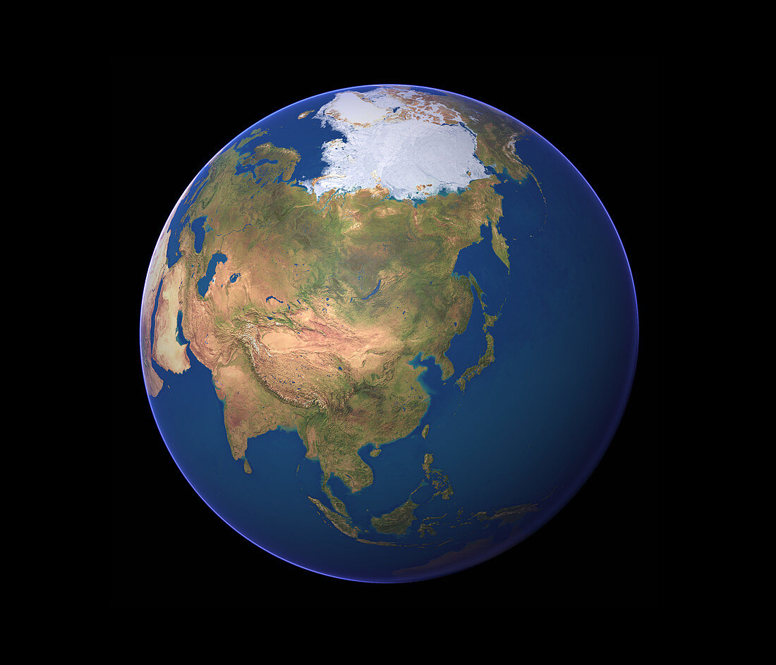
| Earth. Satellite image of the Earth,centred on eastern Asia. North is at top. Water is blue,vegetation is green,arid areas are brown and snow and ice are white. The land mass of Eurasia,the Earth's largest continent,dominates the image. It consists of Asia and Europe (upper left),and is circled by the Arctic (upper centre),Pacific (top to bottom right) and Indian (lower left) oceans | |
| Lizenzart: | Lizenzpflichtig |
| Credit: | Science Photo Library / Planetary Visions |
| Bildgröße: | 3500 px × 3000 px |
| Modell-Rechte: | nicht erforderlich |
| Eigentums-Rechte: | nicht erforderlich |
| Restrictions: | - |
Preise für dieses Bild ab 15 €
Universitäten & Organisationen
(Informationsmaterial Digital, Informationsmaterial Print, Lehrmaterial Digital etc.)
ab 15 €
Redaktionell
(Bücher, Bücher: Sach- und Fachliteratur, Digitale Medien (redaktionell) etc.)
ab 30 €
Werbung
(Anzeigen, Aussenwerbung, Digitale Medien, Fernsehwerbung, Karten, Werbemittel, Zeitschriften etc.)
ab 55 €
Handelsprodukte
(bedruckte Textilie, Kalender, Postkarte, Grußkarte, Verpackung etc.)
ab 75 €
Pauschalpreise
Rechtepakete für die unbeschränkte Bildnutzung in Print oder Online
ab 495 €
Keywords
- 1,
- Arktis,
- Asien,
- Bild,
- Bilder,
- Eis,
- Erde,
- Erdkunde,
- Eurasien,
- Europa,
- Foto,
- Fotos,
- geografisch,
- Geographie,
- Globus,
- horizontal,
- Indisch,
- Kontinent,
- Kontinente,
- Kreis,
- kreisförmig,
- Land,
- Meer,
- Nordpol,
- Observation,
- Ozean,
- Ozeane,
- Pazifik,
- Planet,
- planetarisch,
- rund,
- Satellitenbilder,
- Schnee,
- Vegetation,
- Wasser,
- Welt,
- Weltall,
- Wissenschaften,
- Wüste