Earth
Bildnummer 11735136
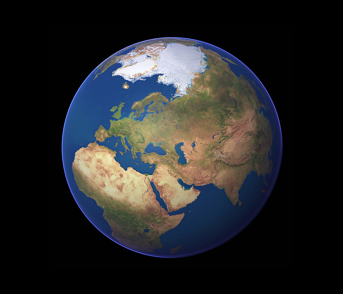
| Earth. Satellite image of the Earth,centred on the Middle East. North is at top. Water is blue,vegetation is green,arid areas are brown and snow and ice are white. The Middle East surrounds the eastern Mediterranean Sea (centre left),includes the Arabian Peninsula (lower centre),and extends eastwards towards India (lower right). The Middle East is surrounded by the rest of Africa (lower left),Europe (upper left),the rest of Asia (upper right) and the Indian Ocean (lower right). The Arctic (top centre) and the northern Atlantic Ocean (upper left) are also seen | |
| Lizenzart: | Lizenzpflichtig |
| Credit: | Science Photo Library / Planetary Visions |
| Bildgröße: | 3500 px × 3000 px |
| Modell-Rechte: | nicht erforderlich |
| Eigentums-Rechte: | nicht erforderlich |
| Restrictions: | - |
Preise für dieses Bild ab 15 €
Universitäten & Organisationen
(Informationsmaterial Digital, Informationsmaterial Print, Lehrmaterial Digital etc.)
ab 15 €
Redaktionell
(Bücher, Bücher: Sach- und Fachliteratur, Digitale Medien (redaktionell) etc.)
ab 30 €
Werbung
(Anzeigen, Aussenwerbung, Digitale Medien, Fernsehwerbung, Karten, Werbemittel, Zeitschriften etc.)
ab 55 €
Handelsprodukte
(bedruckte Textilie, Kalender, Postkarte, Grußkarte, Verpackung etc.)
ab 75 €
Pauschalpreise
Rechtepakete für die unbeschränkte Bildnutzung in Print oder Online
ab 495 €
Keywords
- 1,
- Afrika,
- Arktis,
- Asien,
- Atlantisch,
- Bild,
- Bilder,
- Eis,
- Erde,
- Erdkunde,
- Eurasien,
- Europa,
- Foto,
- Fotos,
- geografisch,
- Geographie,
- Globus,
- horizontal,
- Indisch,
- Kontinent,
- Kontinente,
- Kreis,
- kreisförmig,
- Land,
- Meer,
- Mittelmeer,
- Mittlerer Osten,
- Nordpol,
- Observation,
- Ozean,
- Ozeane,
- Planet,
- planetarisch,
- rund,
- Satellitenbilder,
- Schnee,
- Vegetation,
- Wasser,
- Welt,
- Weltall,
- Wissenschaften,
- Wüste