Whole Earth map
Bildnummer 11735119
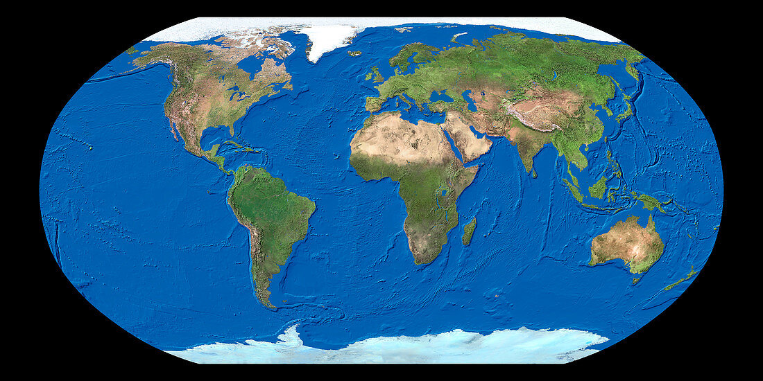
| Whole Earth map. True-colour satellite map of the Earth's land cover and ocean floor topography. The map uses the Robinson projection and is centred around the Greenwich Meridian with North at top. Water is blue,vegetation is green,arid areas are brown and snow and ice are white. Robinson maps project the spherical surface of the Earth onto a pseudocylindrical surface. The vertical lines of longitude increasingly curve to each end of the map. This reduces the distortions of mapping the surface of a sphere onto a flat surface | |
| Lizenzart: | Lizenzpflichtig |
| Credit: | Science Photo Library / Worldsat International |
| Bildgröße: | 4000 px × 2000 px |
| Modell-Rechte: | nicht erforderlich |
| Eigentums-Rechte: | nicht erforderlich |
| Restrictions: |
|
Preise für dieses Bild ab 15 €
Universitäten & Organisationen
(Informationsmaterial Digital, Informationsmaterial Print, Lehrmaterial Digital etc.)
ab 15 €
Redaktionell
(Bücher, Bücher: Sach- und Fachliteratur, Digitale Medien (redaktionell) etc.)
ab 30 €
Werbung
(Anzeigen, Aussenwerbung, Digitale Medien, Fernsehwerbung, Karten, Werbemittel, Zeitschriften etc.)
ab 55 €
Handelsprodukte
(bedruckte Textilie, Kalender, Postkarte, Grußkarte, Verpackung etc.)
ab 75 €
Pauschalpreise
Rechtepakete für die unbeschränkte Bildnutzung in Print oder Online
ab 495 €
Keywords
- 1,
- Afrika,
- Antarktis,
- Arktis,
- Asien,
- Atlantisch,
- Bild,
- Bilder,
- Eis,
- Erdkunde,
- Eurasien,
- Europa,
- Foto,
- Fotos,
- ganze Erdkarte,
- geografisch,
- Geographie,
- Indisch,
- Kartographie,
- Kontinente,
- Land,
- Nordamerika,
- Observation,
- Ozeane,
- Pazifik,
- Planet,
- planetarisch,
- Robinson-Projektion,
- Satellitenbilder,
- Schnee,
- Süden,
- topografisch,
- Topographie,
- Vegetation,
- verzerrt,
- Wasser,
- Weltall,
- Wissenschaften