Whole Earth map
Bildnummer 11735110
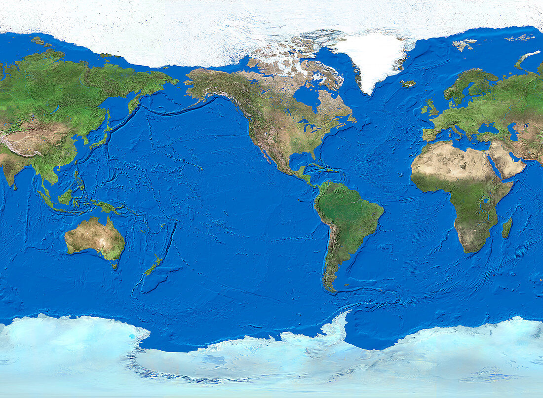
| Whole Earth map. True-colour satellite map of the Earth's land cover and ocean floor topography. The map uses the Miller cylindrical projection and is centred around the American continents with North at top. Water is blue,vegetation is green,arid areas are brown and snow and ice are white. This projection improves on other methods of projection by reducing area distortion and showing the poles. However,areas are still increasingly distorted beyond their true values as you move from the equator to the poles | |
| Lizenzart: | Lizenzpflichtig |
| Credit: | Science Photo Library / Worldsat International |
| Bildgröße: | 4003 px × 2935 px |
| Modell-Rechte: | nicht erforderlich |
| Eigentums-Rechte: | nicht erforderlich |
| Restrictions: |
|
Preise für dieses Bild ab 15 €
Universitäten & Organisationen
(Informationsmaterial Digital, Informationsmaterial Print, Lehrmaterial Digital etc.)
ab 15 €
Redaktionell
(Bücher, Bücher: Sach- und Fachliteratur, Digitale Medien (redaktionell) etc.)
ab 30 €
Werbung
(Anzeigen, Aussenwerbung, Digitale Medien, Fernsehwerbung, Karten, Werbemittel, Zeitschriften etc.)
ab 55 €
Handelsprodukte
(bedruckte Textilie, Kalender, Postkarte, Grußkarte, Verpackung etc.)
ab 75 €
Pauschalpreise
Rechtepakete für die unbeschränkte Bildnutzung in Print oder Online
ab 495 €
Keywords
- 1,
- Afrika,
- Antarktis,
- Arktis,
- Asien,
- Atlantisch,
- Bild,
- Bilder,
- Eis,
- Erdkunde,
- Eurasien,
- Europa,
- Foto,
- Fotos,
- ganze Erdkarte,
- geografisch,
- Geographie,
- Indisch,
- Kartographie,
- Kontinente,
- Land,
- Nordamerika,
- Nordpol,
- Observation,
- Ozeane,
- Pazifik,
- Planet,
- planetarisch,
- Satellitenbilder,
- Schnee,
- Süden,
- Südpol,
- topografisch,
- Topographie,
- Vegetation,
- verzerrt,
- Wasser,
- Weltall,
- Wissenschaften