Whole Earth map
Bildnummer 11735108
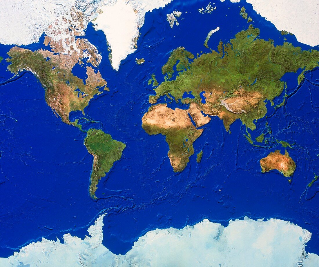
| Whole Earth map. True-colour satellite map of the Earth's land cover and ocean floor topography. The map uses the Mercator projection and is centred around the Greenwich Meridian with North at top. Water is blue,vegetation is green,arid areas are brown and snow and ice are white. Mercator maps project the spherical surface of the Earth onto a cylindrical surface (which is unrolled to form the map). Areas are increasingly distorted when moving from the equator to the poles. Greenland should be about eight times smaller than South America | |
| Lizenzart: | Lizenzpflichtig |
| Credit: | Science Photo Library / Worldsat International |
| Bildgröße: | 4724 px × 3954 px |
| Modell-Rechte: | nicht erforderlich |
| Eigentums-Rechte: | nicht erforderlich |
| Restrictions: |
|
Preise für dieses Bild ab 15 €
Universitäten & Organisationen
(Informationsmaterial Digital, Informationsmaterial Print, Lehrmaterial Digital etc.)
ab 15 €
Redaktionell
(Bücher, Bücher: Sach- und Fachliteratur, Digitale Medien (redaktionell) etc.)
ab 30 €
Werbung
(Anzeigen, Aussenwerbung, Digitale Medien, Fernsehwerbung, Karten, Werbemittel, Zeitschriften etc.)
ab 55 €
Handelsprodukte
(bedruckte Textilie, Kalender, Postkarte, Grußkarte, Verpackung etc.)
ab 75 €
Pauschalpreise
Rechtepakete für die unbeschränkte Bildnutzung in Print oder Online
ab 495 €
Keywords
- 1,
- Afrika,
- Antarktis,
- Arktis,
- Asien,
- Atlantisch,
- Bild,
- Bilder,
- Eis,
- Erdkunde,
- Eurasien,
- Europa,
- Foto,
- Fotos,
- ganze Erdkarte,
- geografisch,
- Geographie,
- Indisch,
- Kartographie,
- Kontinente,
- Land,
- Nordamerika,
- Observation,
- Ozeane,
- Pazifik,
- Planet,
- planetarisch,
- Satellitenbilder,
- Schnee,
- Süden,
- topografisch,
- Topographie,
- Vegetation,
- verzerrt,
- Wasser,
- Welt,
- Weltall,
- Wissenschaften