Whole Earth map
Bildnummer 11735106
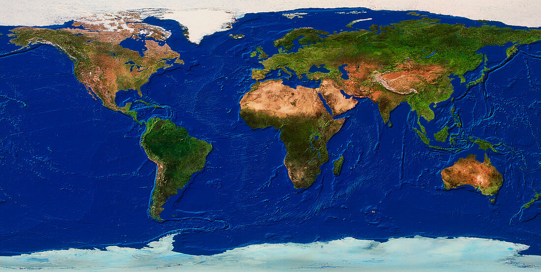
| Whole Earth map. True-colour satellite map of the Earth's land cover and ocean floor topography. The map is centred around the Greenwich Meridian and North is at top. Vegetation is green,water is blue,arid areas are brown and snow and ice are white. The vast deserts (brown) of northern Africa are seen just above centre. Ocean topography includes the Mid-Atlantic Ridge (left of centre) and continental shelves. A continental shelf is seen off the shores of the British Isles of north- western Europe (upper centre) | |
| Lizenzart: | Lizenzpflichtig |
| Credit: | Science Photo Library / Worldsat International |
| Bildgröße: | 5925 px × 2989 px |
| Modell-Rechte: | nicht erforderlich |
| Eigentums-Rechte: | nicht erforderlich |
| Restrictions: |
|
Preise für dieses Bild ab 15 €
Universitäten & Organisationen
(Informationsmaterial Digital, Informationsmaterial Print, Lehrmaterial Digital etc.)
ab 15 €
Redaktionell
(Bücher, Bücher: Sach- und Fachliteratur, Digitale Medien (redaktionell) etc.)
ab 30 €
Werbung
(Anzeigen, Aussenwerbung, Digitale Medien, Fernsehwerbung, Karten, Werbemittel, Zeitschriften etc.)
ab 55 €
Handelsprodukte
(bedruckte Textilie, Kalender, Postkarte, Grußkarte, Verpackung etc.)
ab 75 €
Pauschalpreise
Rechtepakete für die unbeschränkte Bildnutzung in Print oder Online
ab 495 €
Keywords
- 1,
- Afrika,
- Antarktis,
- Arktis,
- Asien,
- Atlantisch,
- Bild,
- Bilder,
- Eis,
- Erdkunde,
- Eurasien,
- Europa,
- Foto,
- Fotos,
- ganze Erdkarte,
- geografisch,
- Geographie,
- Indisch,
- Kartographie,
- Kontinente,
- Land,
- Nordamerika,
- Observation,
- Ozeane,
- Pazifik,
- Planet,
- planetarisch,
- Satellitenbilder,
- Schnee,
- Süden,
- topografisch,
- Topographie,
- Vegetation,
- Wasser,
- Weltall,
- Wissenschaften