Whole Earth (Blue Marble 2000)
Bildnummer 11735096
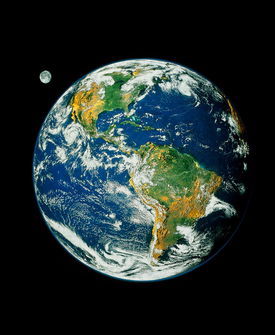
| Whole Earth. Composite satellite image of Earth centred on the Americas. This is Blue Marble 2000,one of the most detailed Earth images ever made. It was done to update the original "blue marble" images taken by Apollo astronauts. It is the result of the combination of data from three Earth-observing satellites. A GOES satellite took the overall Earth image,SeaWiFS gathered ocean colour data and the AVHRR instruments on POES satellites mapped the vegetation. Hurricane Linda,a huge spiral storm system,is at centre left. Relief features have been exaggerated by 50 times. The Moon (upper left) has been superimposed on the image,and is not to scale | |
| Lizenzart: | Lizenzpflichtig |
| Credit: | Science Photo Library / NASA's Goddard Space Flight Center |
| Bildgröße: | 4074 px × 4961 px |
| Modell-Rechte: | nicht erforderlich |
| Eigentums-Rechte: | nicht erforderlich |
| Restrictions: | - |
Preise für dieses Bild ab 15 €
Universitäten & Organisationen
(Informationsmaterial Digital, Informationsmaterial Print, Lehrmaterial Digital etc.)
ab 15 €
Redaktionell
(Bücher, Bücher: Sach- und Fachliteratur, Digitale Medien (redaktionell) etc.)
ab 30 €
Werbung
(Anzeigen, Aussenwerbung, Digitale Medien, Fernsehwerbung, Karten, Werbemittel, Zeitschriften etc.)
ab 55 €
Handelsprodukte
(bedruckte Textilie, Kalender, Postkarte, Grußkarte, Verpackung etc.)
ab 75 €
Pauschalpreise
Rechtepakete für die unbeschränkte Bildnutzung in Print oder Online
ab 495 €
Keywords
- Anden,
- Atlantisch,
- Berge,
- Bild,
- Bilder,
- Erdkunde,
- Felsig,
- Foto,
- Fotos,
- ganze Erde,
- Geographie,
- Gerundet,
- Globus,
- Hurrikan linda,
- Karibisches Meer,
- kreisförmig,
- Kugel,
- kugelförmig,
- Meteorologie,
- Mond,
- NASA,
- NOAA,
- Norden,
- Ozeane,
- Pazifik,
- POES,
- Rockies,
- Süden,
- Weltall,
- Wissenschaften,
- Wolken,
- zentral