Whole Earth centred on South America
Bildnummer 11735039
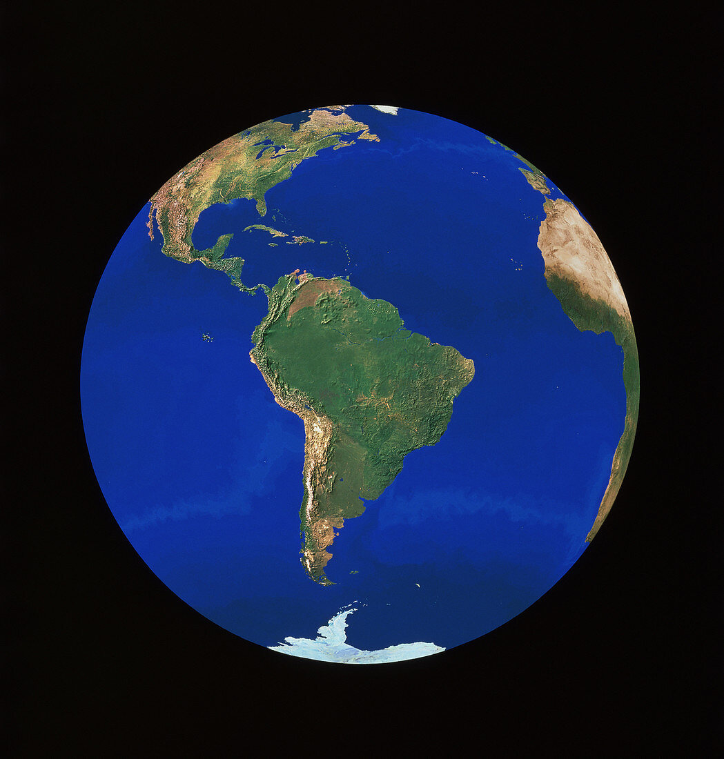
| Whole Earth centred on South America,showing also the continents of North America (at top) and Africa (at right). This image is a combination of hundreds of images acquired by NOAA weather satellites from orbits some 820 km above Earth. Each frame has a resolution of 1 kilometre. The mosaic of frames was then combined with a high-resolution digital elevation model. To emphasize relief features,the elevation model was stretched by a factor of two,and simulated solar illumination added | |
| Lizenzart: | Lizenzpflichtig |
| Credit: | Science Photo Library / Worldsat International / Knighton, J. |
| Bildgröße: | 3659 px × 3837 px |
| Modell-Rechte: | nicht erforderlich |
| Eigentums-Rechte: | nicht erforderlich |
| Restrictions: |
|
Preise für dieses Bild ab 15 €
Universitäten & Organisationen
(Informationsmaterial Digital, Informationsmaterial Print, Lehrmaterial Digital etc.)
ab 15 €
Redaktionell
(Bücher, Bücher: Sach- und Fachliteratur, Digitale Medien (redaktionell) etc.)
ab 30 €
Werbung
(Anzeigen, Aussenwerbung, Digitale Medien, Fernsehwerbung, Karten, Werbemittel, Zeitschriften etc.)
ab 55 €
Handelsprodukte
(bedruckte Textilie, Kalender, Postkarte, Grußkarte, Verpackung etc.)
ab 75 €
Pauschalpreise
Rechtepakete für die unbeschränkte Bildnutzung in Print oder Online
ab 495 €