Whole earth with ocean bathymetry
Bildnummer 11735009
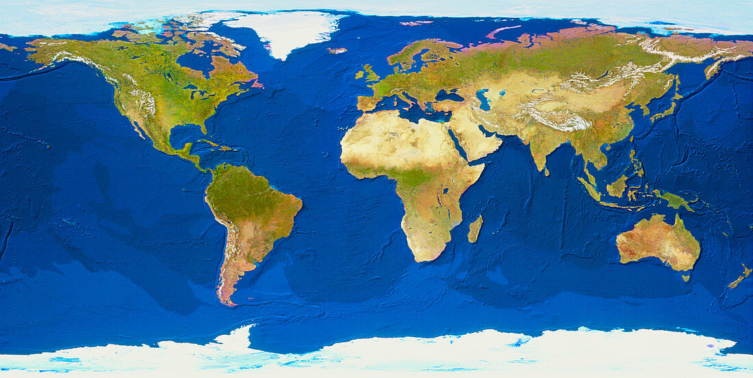
| Whole Earth with ocean bathymetry. Geosphere computer-generated view of the whole Earth,in rectangular projection,centred on the Atlantic Ocean. Land cover information from thousands of satellite images has been merged with ocean topography data from the US Geological Survey. Blue shading represents sea temperature,dark blue being warmer. Ocean topography includes the Mid- Atlantic Ridge,Indian Ocean ridges,and the dark lines of the trenches on the edge of the Pacific plate. Many continental shelves are also evident | |
| Lizenzart: | Lizenzpflichtig |
| Credit: | Science Photo Library / GEOSPHERE PROJECT, SANTA MONICA / COPYRIGHT TOM VAN SANT |
| Bildgröße: | 6506 px × 3265 px |
| Modell-Rechte: | nicht erforderlich |
| Eigentums-Rechte: | nicht erforderlich |
| Restrictions: |
|
Preise für dieses Bild ab 15 €
Universitäten & Organisationen
(Informationsmaterial Digital, Informationsmaterial Print, Lehrmaterial Digital etc.)
ab 15 €
Redaktionell
(Bücher, Bücher: Sach- und Fachliteratur, Digitale Medien (redaktionell) etc.)
ab 30 €
Werbung
(Anzeigen, Aussenwerbung, Digitale Medien, Fernsehwerbung, Karten, Werbemittel, Zeitschriften etc.)
ab 55 €
Handelsprodukte
(bedruckte Textilie, Kalender, Postkarte, Grußkarte, Verpackung etc.)
ab 75 €
Pauschalpreise
Rechtepakete für die unbeschränkte Bildnutzung in Print oder Online
ab 495 €