GeoSphere map with political boundaries
Bildnummer 11735007
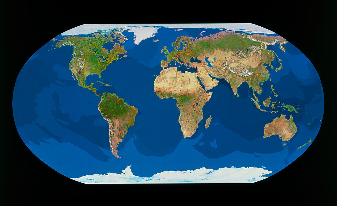
| GeoSphere image of the whole Earth in a Robinson Projection with political boundaries. Colours in land areas show natural tones,sea colours give an impression of water temperatures (light blue = cool,dark blue = warm). Boundaries between countries are shown in red,and are correct as at late 1993. This image is a composite of thousands of images made by the NOAA series of weather satellites. Each image was selected for lack of cloud cover and the representation of the surface colours. The individual frames were then merged using a graphics computer | |
| Lizenzart: | Lizenzpflichtig |
| Credit: | Science Photo Library / GEOSPHERE PROJECT, SANTA MONICA / COPYRIGHT TOM VAN SANT |
| Bildgröße: | 5433 px × 3320 px |
| Modell-Rechte: | nicht erforderlich |
| Eigentums-Rechte: | nicht erforderlich |
| Restrictions: |
|
Preise für dieses Bild ab 15 €
Universitäten & Organisationen
(Informationsmaterial Digital, Informationsmaterial Print, Lehrmaterial Digital etc.)
ab 15 €
Redaktionell
(Bücher, Bücher: Sach- und Fachliteratur, Digitale Medien (redaktionell) etc.)
ab 30 €
Werbung
(Anzeigen, Aussenwerbung, Digitale Medien, Fernsehwerbung, Karten, Werbemittel, Zeitschriften etc.)
ab 55 €
Handelsprodukte
(bedruckte Textilie, Kalender, Postkarte, Grußkarte, Verpackung etc.)
ab 75 €
Pauschalpreise
Rechtepakete für die unbeschränkte Bildnutzung in Print oder Online
ab 495 €