Whole earth & seabed
Bildnummer 11735005
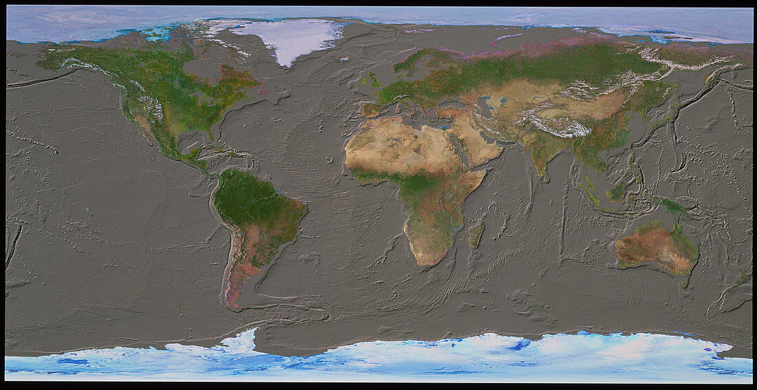
| Topography of the world's oceans. Computer image of the Earth in rectangular projection,centered on the Atlantic Ocean. Land cover information taken from satellite images has been merged with an ocean topography model from the US Geological Survey. Clearly seen are tectonic faults,such as the Mid- Atlantic Ridge (centre) and the destructive margin trenches of the Pacific Rim (left and right): Also clear are the continental shelves of Europe (top centre),North America (top left),South America's east coast (lower centre left),and south-east Australasia (bottom right) | |
| Lizenzart: | Lizenzpflichtig |
| Credit: | Science Photo Library / GEOSPHERE PROJECT, SANTA MONICA / COPYRIGHT TOM VAN SANT |
| Bildgröße: | 5265 px × 2712 px |
| Modell-Rechte: | nicht erforderlich |
| Eigentums-Rechte: | nicht erforderlich |
| Restrictions: |
|
Preise für dieses Bild ab 15 €
Universitäten & Organisationen
(Informationsmaterial Digital, Informationsmaterial Print, Lehrmaterial Digital etc.)
ab 15 €
Redaktionell
(Bücher, Bücher: Sach- und Fachliteratur, Digitale Medien (redaktionell) etc.)
ab 30 €
Werbung
(Anzeigen, Aussenwerbung, Digitale Medien, Fernsehwerbung, Karten, Werbemittel, Zeitschriften etc.)
ab 55 €
Handelsprodukte
(bedruckte Textilie, Kalender, Postkarte, Grußkarte, Verpackung etc.)
ab 75 €
Pauschalpreise
Rechtepakete für die unbeschränkte Bildnutzung in Print oder Online
ab 495 €