GeoSphere with bathymetry,Pacific Ocean
Bildnummer 11734991
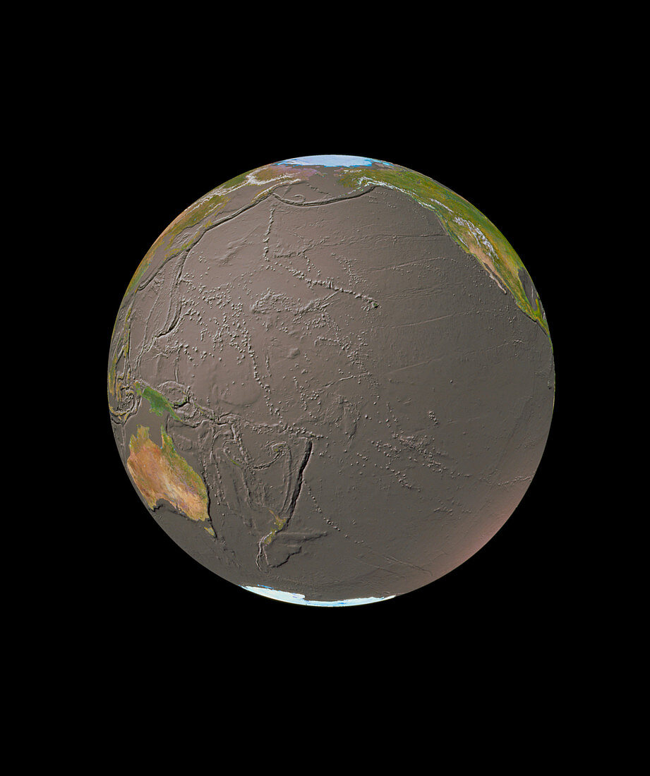
| GeoSphere mosaic satellite image of the whole Earth showing bathymetry of the Pacific Ocean. Here,land cover information from satellite images is merged with an ocean topography map. The shading highlights many features of the ocean. These include the vast trench systems on the edge of the Pacific plate,such as the Aleutian/Kuril/ Japan complex at upper left. The deepest is the Marianas Trench (just above left centre),at 10,863 metres. Just above centre is a line of volcanoes,at the right end of which is Hawaii,created as the Pacific plate moved over a hot spot in the Earth's mantle below | |
| Lizenzart: | Lizenzpflichtig |
| Credit: | Science Photo Library / GEOSPHERE PROJECT, SANTA MONICA / COPYRIGHT TOM VAN SANT |
| Bildgröße: | 2597 px × 3101 px |
| Modell-Rechte: | nicht erforderlich |
| Eigentums-Rechte: | nicht erforderlich |
| Restrictions: |
|
Preise für dieses Bild ab 15 €
Universitäten & Organisationen
(Informationsmaterial Digital, Informationsmaterial Print, Lehrmaterial Digital etc.)
ab 15 €
Redaktionell
(Bücher, Bücher: Sach- und Fachliteratur, Digitale Medien (redaktionell) etc.)
ab 30 €
Werbung
(Anzeigen, Aussenwerbung, Digitale Medien, Fernsehwerbung, Karten, Werbemittel, Zeitschriften etc.)
ab 55 €
Handelsprodukte
(bedruckte Textilie, Kalender, Postkarte, Grußkarte, Verpackung etc.)
ab 75 €
Pauschalpreise
Rechtepakete für die unbeschränkte Bildnutzung in Print oder Online
ab 495 €