Topographical map of the world
Bildnummer 11734986
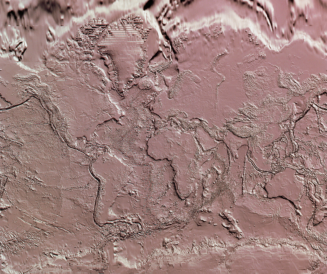
| Topographical map of the world. Relief-shaded topographical map of the world,showing only the relative elevation of the Earth's surface as it would appear without the seas and oceans. This map reveals many tectonic faults,such as the Mid- Atlantic Ridge (left of centre) and the deep subduction faults of the Pacific rim (left and far right). Most of the plate surfaces are flat,with mountains mainly at plate margins. The distortions at the far top and bottom of the frame are a function of the mapping process. The data for this image were gathered by a variety of survey techniques | |
| Lizenzart: | Lizenzpflichtig |
| Credit: | Science Photo Library / NRSC LTD |
| Bildgröße: | 4927 px × 4127 px |
| Modell-Rechte: | nicht erforderlich |
| Eigentums-Rechte: | nicht erforderlich |
| Restrictions: | - |
Preise für dieses Bild ab 15 €
Universitäten & Organisationen
(Informationsmaterial Digital, Informationsmaterial Print, Lehrmaterial Digital etc.)
ab 15 €
Redaktionell
(Bücher, Bücher: Sach- und Fachliteratur, Digitale Medien (redaktionell) etc.)
ab 30 €
Werbung
(Anzeigen, Aussenwerbung, Digitale Medien, Fernsehwerbung, Karten, Werbemittel, Zeitschriften etc.)
ab 55 €
Handelsprodukte
(bedruckte Textilie, Kalender, Postkarte, Grußkarte, Verpackung etc.)
ab 75 €
Pauschalpreise
Rechtepakete für die unbeschränkte Bildnutzung in Print oder Online
ab 495 €
Keywords
- Bild,
- Bilder,
- Erde,
- Erdkunde,
- Foto,
- Fotos,
- ganze Erde,
- Karte,
- Meeresboden,
- Topographie,
- Welt,
- Wissenschaften