GeoSphere whole Earth centred on Himalayas
Bildnummer 11734981
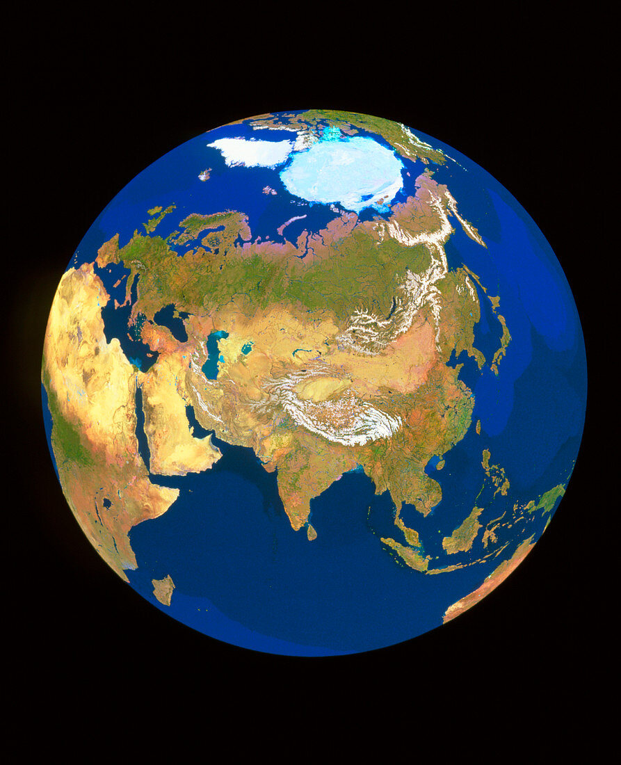
| GeoSphere satellite mosaic image of the whole Earth centred on the Himalayas. This view is dominated by the vast land mass of Eurasia,consisting of Europe (toward upper left) and Asia (centre). Near the top is the pale blue Arctic ice cap and the white ice-covered island of Greenland. At left is Africa and the Middle East. Toward bottom right is South-East Asia,with part of Australia visible at the limb. This view was produced by combining thousands of satellite images,each selected for its lack of cloud and representation of surface features | |
| Lizenzart: | Lizenzpflichtig |
| Credit: | Science Photo Library / GEOSPHERE PROJECT, SANTA MONICA / COPYRIGHT TOM VAN SANT |
| Bildgröße: | 2875 px × 3543 px |
| Modell-Rechte: | nicht erforderlich |
| Eigentums-Rechte: | nicht erforderlich |
| Restrictions: |
|
Preise für dieses Bild ab 15 €
Universitäten & Organisationen
(Informationsmaterial Digital, Informationsmaterial Print, Lehrmaterial Digital etc.)
ab 15 €
Redaktionell
(Bücher, Bücher: Sach- und Fachliteratur, Digitale Medien (redaktionell) etc.)
ab 30 €
Werbung
(Anzeigen, Aussenwerbung, Digitale Medien, Fernsehwerbung, Karten, Werbemittel, Zeitschriften etc.)
ab 55 €
Handelsprodukte
(bedruckte Textilie, Kalender, Postkarte, Grußkarte, Verpackung etc.)
ab 75 €
Pauschalpreise
Rechtepakete für die unbeschränkte Bildnutzung in Print oder Online
ab 495 €