GeoSphere whole Earth centred on N.America (11/92)
Bildnummer 11734980
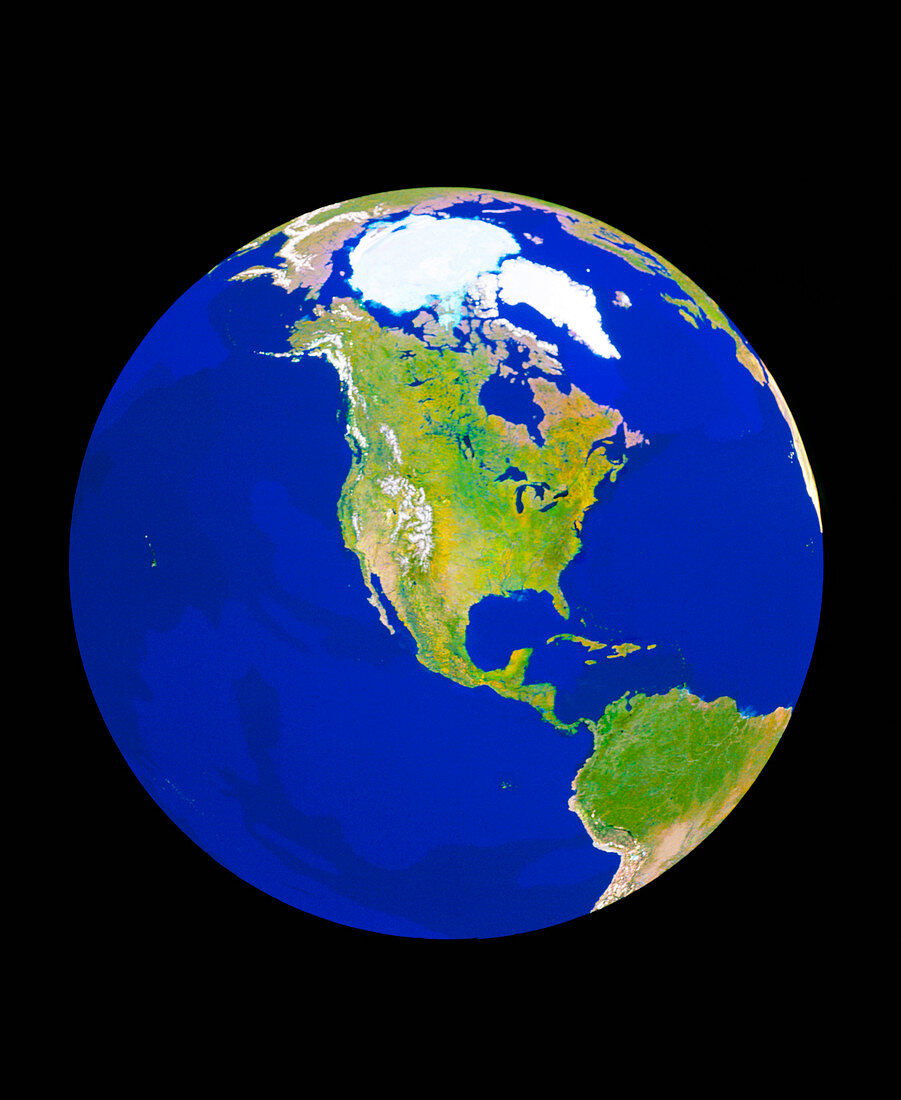
| GeoSphere satellite mosaic image of the whole Earth centred on North America. The pale blue Arctic icecap near the top is seen next to the white ice-covered island of Greenland. At bottom right is part of South America. Northern Europe is at top right,with the north coast of Russia along the top of the limb. The bright patch at centre right is the western coast of Africa. This view was produced by combining thousands of individual satellite frames,each chosen for a lack of cloud and the best representation of surface features | |
| Lizenzart: | Lizenzpflichtig |
| Credit: | Science Photo Library / GEOSPHERE PROJECT, SANTA MONICA / COPYRIGHT TOM VAN SANT |
| Bildgröße: | 2901 px × 3543 px |
| Modell-Rechte: | nicht erforderlich |
| Eigentums-Rechte: | nicht erforderlich |
| Restrictions: |
|
Preise für dieses Bild ab 15 €
Universitäten & Organisationen
(Informationsmaterial Digital, Informationsmaterial Print, Lehrmaterial Digital etc.)
ab 15 €
Redaktionell
(Bücher, Bücher: Sach- und Fachliteratur, Digitale Medien (redaktionell) etc.)
ab 30 €
Werbung
(Anzeigen, Aussenwerbung, Digitale Medien, Fernsehwerbung, Karten, Werbemittel, Zeitschriften etc.)
ab 55 €
Handelsprodukte
(bedruckte Textilie, Kalender, Postkarte, Grußkarte, Verpackung etc.)
ab 75 €
Pauschalpreise
Rechtepakete für die unbeschränkte Bildnutzung in Print oder Online
ab 495 €