Whole Earth
Bildnummer 11734925
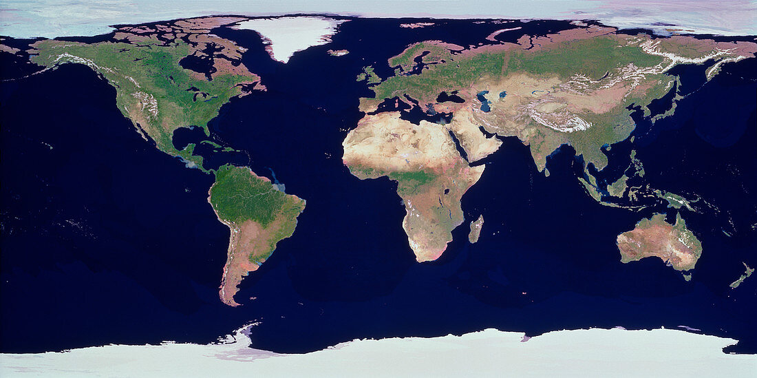
| Satellite image of the Earth in rectangular projection. The picture is a composite created from thousands of separate images recorded by the Tiros-N series of meteorological satellites of NOAA. Each Tiros image was selected to best show the characteristics of a particular region. The chosen images were compiled into a vast database using a supercomputer which then generated this composite picture. The picture is one of the results of the GeoSphere Project,created by Tom Van Sant in Santa Monica,California | |
| Lizenzart: | Lizenzpflichtig |
| Credit: | Science Photo Library / GEOSPHERE PROJECT, SANTA MONICA / COPYRIGHT TOM VAN SANT |
| Bildgröße: | 5323 px × 2656 px |
| Modell-Rechte: | nicht erforderlich |
| Eigentums-Rechte: | nicht erforderlich |
| Restrictions: |
|
Preise für dieses Bild ab 15 €
Universitäten & Organisationen
(Informationsmaterial Digital, Informationsmaterial Print, Lehrmaterial Digital etc.)
ab 15 €
Redaktionell
(Bücher, Bücher: Sach- und Fachliteratur, Digitale Medien (redaktionell) etc.)
ab 30 €
Werbung
(Anzeigen, Aussenwerbung, Digitale Medien, Fernsehwerbung, Karten, Werbemittel, Zeitschriften etc.)
ab 55 €
Handelsprodukte
(bedruckte Textilie, Kalender, Postkarte, Grußkarte, Verpackung etc.)
ab 75 €
Pauschalpreise
Rechtepakete für die unbeschränkte Bildnutzung in Print oder Online
ab 495 €