SMAP satellite,illustration
Bildnummer 11731757
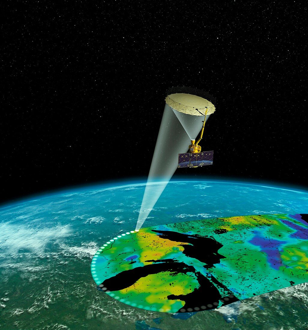
| SMAP satellite. Illustration of the operation of the Soil Moisture Active Passive (SMAP) satellite,mapping the Earth's surface. This orbiting observatory measures the amount of water in the top 5 centimetres of soil everywhere on Earth's surface. It provides measurements of the soil moisture and freeze-thaw state,completing global coverage every 2 to 3 days. The data it gathers will enhance understanding of links between the terrestrial water,energy,and carbon cycles,and improve weather forecasting,flood prediction and drought monitoring. The SMAP satellite was launched on 31 January 2015 | |
| Lizenzart: | Lizenzpflichtig |
| Credit: | Science Photo Library / JPL-Caltech / NASA |
| Bildgröße: | 4439 px × 4760 px |
| Modell-Rechte: | nicht erforderlich |
| Eigentums-Rechte: | nicht erforderlich |
| Restrictions: | - |
Preise für dieses Bild ab 15 €
Universitäten & Organisationen
(Informationsmaterial Digital, Informationsmaterial Print, Lehrmaterial Digital etc.)
ab 15 €
Redaktionell
(Bücher, Bücher: Sach- und Fachliteratur, Digitale Medien (redaktionell) etc.)
ab 30 €
Werbung
(Anzeigen, Aussenwerbung, Digitale Medien, Fernsehwerbung, Karten, Werbemittel, Zeitschriften etc.)
ab 55 €
Handelsprodukte
(bedruckte Textilie, Kalender, Postkarte, Grußkarte, Verpackung etc.)
ab 75 €
Pauschalpreise
Rechtepakete für die unbeschränkte Bildnutzung in Print oder Online
ab 495 €
Keywords
- 21. Jahrhundert,
- Alter,
- April,
- Astronomie,
- astronomisch,
- Beweis,
- Blaubeere,
- Blaubeeren,
- Close-up,
- Eisen,
- Erforschung,
- Erkundung,
- Felsen,
- Geologie,
- geologisch,
- Hämatit,
- Kieselstein,
- klein,
- Kugel,
- Mars,
- Mars Exploration Rover,
- Mineral,
- Nahansicht,
- Niemand,
- Oberfläche,
- Partikel,
- planetarisch,
- Planetenwissenschaft,
- Raum,
- Reich,
- Sand,
- Sonnensystem,
- Stein,
- Umwelt,
- vom Mars,
- Wasser,
- Wüste