Strait of Magellan,17th century
Bildnummer 11730822
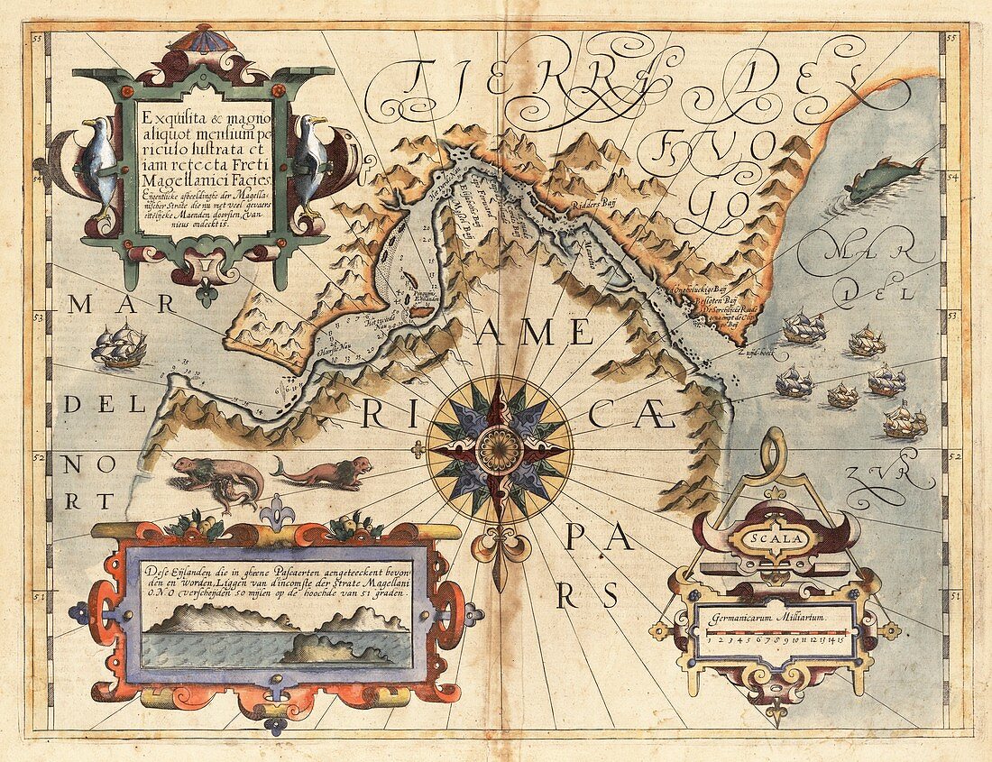
| Strait of Magellan. 17th-century map of the Strait of Magellan with the South American mainland (to the north) at bottom and Tierra del Fuego (to the south) at top. The strait is named for Ferdinand Magellan who navigated it in 1520 on his voyage around the world. The text and labels are in Latin and Dutch,with a panorama at lower left and sailing ships in the Pacific (Mar del Sur,right) and Atlantic (Mar del Norte,left). The numbers in the strait are sounding readings. This map,published in Amsterdam in 1611 by Dutch cartographer Jodocus Hondius (1563-1612),is from Mercator's 'Atlas sive Cosmographicae',based on a 1570 map by Ortelius | |
| Lizenzart: | Lizenzpflichtig |
| Credit: | Science Photo Library / LIBRARY OF CONGRESS, Geography and Map Division |
| Bildgröße: | 5843 px × 4488 px |
| Modell-Rechte: | nicht erforderlich |
| Eigentums-Rechte: | nicht erforderlich |
| Restrictions: | - |
Preise für dieses Bild ab 15 €
Universitäten & Organisationen
(Informationsmaterial Digital, Informationsmaterial Print, Lehrmaterial Digital etc.)
ab 15 €
Redaktionell
(Bücher, Bücher: Sach- und Fachliteratur, Digitale Medien (redaktionell) etc.)
ab 30 €
Werbung
(Anzeigen, Aussenwerbung, Digitale Medien, Fernsehwerbung, Karten, Werbemittel, Zeitschriften etc.)
ab 55 €
Handelsprodukte
(bedruckte Textilie, Kalender, Postkarte, Grußkarte, Verpackung etc.)
ab 75 €
Pauschalpreise
Rechtepakete für die unbeschränkte Bildnutzung in Print oder Online
ab 495 €
Keywords
- 1500er Jahre,
- 16. Jahrhundert,
- 1600er Jahre,
- 17. Jahrhundert,
- Antarktis,
- Atlantisch,
- Erkundung,
- geografisch,
- Geographie,
- Gerardus Mercator,
- Geschichte,
- historisch,
- Illustration,
- Karte,
- Kartographie,
- Kunstwerk,
- Latein,
- Lateinamerika,
- Magellanstraße,
- Meer,
- Niederländisch,
- Niemand,
- Ozeane,
- Pazifik,
- Segelschiffe,
- Südamerika,
- Südamerikanisch