Africa,1595 Mercator atlas
Bildnummer 11730644
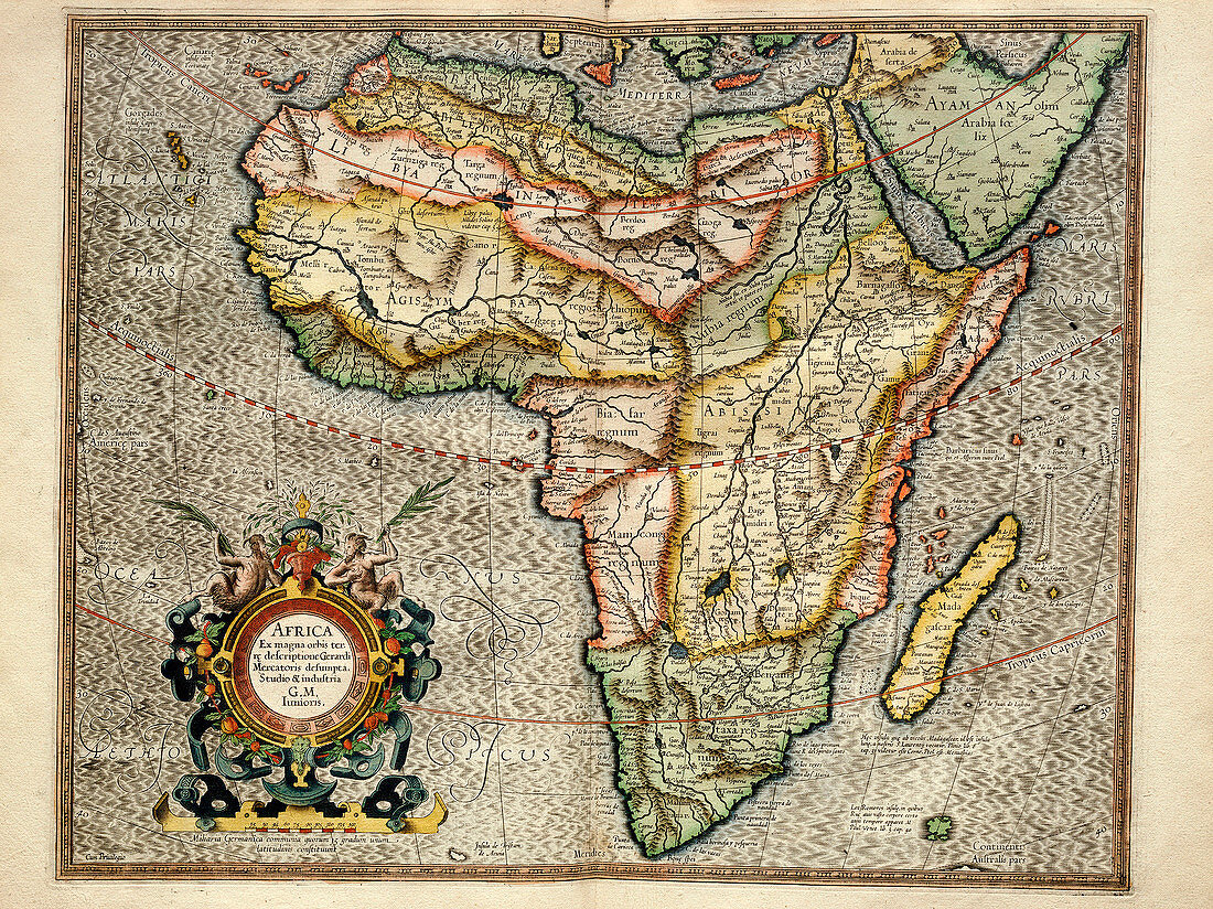
| Africa,1595 Mercator atlas. 16th-century Dutch map of Africa with inscriptions and labels in Latin. Historic regions shown here include the Barbary Coast,Biledulgerid,Libya Interior,Agisymba,Nubia,Abyssinia,Biafra,Manicongo. These names were used by Ptolemy to describe Africa in the 2nd century,with much of the interior still unknown in the 16th century. The inscription at lower left says the map is by Gerard Mercator Junior,based on maps by his grandfather,Flemish cartographer Gerardus Mercator (1512-1594). This copy of the map is from 'Atlas Sive Cosmographicae Meditationes de Fabrica Mundi et Fabricati Figura' (Duisburg,1595) | |
| Lizenzart: | Lizenzpflichtig |
| Credit: | Science Photo Library / LIBRARY OF CONGRESS, Geography and Map Division |
| Bildgröße: | 3454 px × 2587 px |
| Modell-Rechte: | nicht erforderlich |
| Eigentums-Rechte: | nicht erforderlich |
| Restrictions: | - |
Preise für dieses Bild ab 15 €
Universitäten & Organisationen
(Informationsmaterial Digital, Informationsmaterial Print, Lehrmaterial Digital etc.)
ab 15 €
Redaktionell
(Bücher, Bücher: Sach- und Fachliteratur, Digitale Medien (redaktionell) etc.)
ab 30 €
Werbung
(Anzeigen, Aussenwerbung, Digitale Medien, Fernsehwerbung, Karten, Werbemittel, Zeitschriften etc.)
ab 55 €
Handelsprodukte
(bedruckte Textilie, Kalender, Postkarte, Grußkarte, Verpackung etc.)
ab 75 €
Pauschalpreise
Rechtepakete für die unbeschränkte Bildnutzung in Print oder Online
ab 495 €