World map,1595 Mercator atlas
Bildnummer 11730642
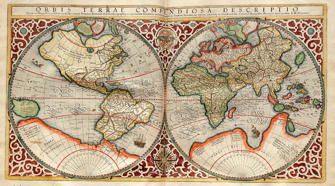
| World map,1595 Mercator atlas. 16th-century Dutch world map,with its Latin title: 'Orbis Terrae Compendiosa Descriptio' It shows the New World being discovered by Europeans exploring the Western Hemisphere. The North and South American continents and the Far East are distorted because they had not yet been accurately mapped. The large Terra Australis continent (white,bottom) represents the unknown far south. This 1587 map by Rumold Mercator is based on the 1569 map by his father,Flemish cartographer Gerardus Mercator (1512-1594). This copy is from 'Atlas Sive Cosmographicae Meditationes' (Duisberg,1595) | |
| Lizenzart: | Lizenzpflichtig |
| Credit: | Science Photo Library / LIBRARY OF CONGRESS, Geography and Map Division |
| Bildgröße: | 4375 px × 2433 px |
| Modell-Rechte: | nicht erforderlich |
| Eigentums-Rechte: | nicht erforderlich |
| Restrictions: | - |
Preise für dieses Bild ab 15 €
Universitäten & Organisationen
(Informationsmaterial Digital, Informationsmaterial Print, Lehrmaterial Digital etc.)
ab 15 €
Redaktionell
(Bücher, Bücher: Sach- und Fachliteratur, Digitale Medien (redaktionell) etc.)
ab 30 €
Werbung
(Anzeigen, Aussenwerbung, Digitale Medien, Fernsehwerbung, Karten, Werbemittel, Zeitschriften etc.)
ab 55 €
Handelsprodukte
(bedruckte Textilie, Kalender, Postkarte, Grußkarte, Verpackung etc.)
ab 75 €
Pauschalpreise
Rechtepakete für die unbeschränkte Bildnutzung in Print oder Online
ab 495 €
Keywords
- 1500er Jahre,
- 16. Jahrhundert,
- Afrika,
- Afrikanisch,
- Asiatisch,
- Asien,
- Atlas,
- beschriftet,
- Erde,
- Etikette,
- Etiketten,
- Europa,
- europäisch,
- Flämisch,
- geografisch,
- Geographie,
- Gerardus Mercator,
- Geschichte,
- Hemisphären,
- historisch,
- Inschrift,
- Karte,
- Kartographie,
- Latein,
- Neue Welt,
- Niederländisch,
- Niemand,
- Nordamerika,
- nordamerikanisch,
- Planet,
- Südamerika,
- Südamerikanisch,
- Terra Australis,
- Text,
- Titel,
- Veröffentlichung,
- Welt,
- Weltkarte,
- Western