Navigational quadrant,16th century
Bildnummer 11730214
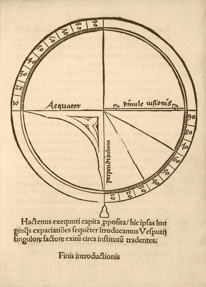
| Navigational quadrant. 16th-century illustration of a quadrant used to measure angles and used in geography,astronomy and navigation. The sectors are labelled with 90 degrees,which here is the latitude on the Earth or celestial sphere. The Latin labels refer to the equator (left),the quadrant sights (right) and the plumb-line (lower centre). Diagram from 'Cosmographiae introductio' (1507),printed to accompany the globe and world map produced by German cartographer Martin Waldseemuller (c.1470-1520). They contained the first use of the name America to refer to the New World,honouring the supposed discoverer of the continent,Amerigo Vespucci | |
| Lizenzart: | Lizenzpflichtig |
| Credit: | Science Photo Library / Library of Congress |
| Bildgröße: | 2536 px × 3520 px |
| Modell-Rechte: | nicht erforderlich |
| Eigentums-Rechte: | nicht erforderlich |
| Restrictions: | - |
Preise für dieses Bild ab 15 €
Universitäten & Organisationen
(Informationsmaterial Digital, Informationsmaterial Print, Lehrmaterial Digital etc.)
ab 15 €
Redaktionell
(Bücher, Bücher: Sach- und Fachliteratur, Digitale Medien (redaktionell) etc.)
ab 30 €
Werbung
(Anzeigen, Aussenwerbung, Digitale Medien, Fernsehwerbung, Karten, Werbemittel, Zeitschriften etc.)
ab 55 €
Handelsprodukte
(bedruckte Textilie, Kalender, Postkarte, Grußkarte, Verpackung etc.)
ab 75 €
Pauschalpreise
Rechtepakete für die unbeschränkte Bildnutzung in Print oder Online
ab 495 €
Keywords
- 1500er Jahre,
- 16. Jahrhundert,
- Amerika,
- Äquator,
- Ausrüstung,
- Blatt,
- Buch,
- Cosmographiae introductio,
- Diagramm,
- Einfarbig,
- Entdeckung,
- Erkundung,
- geografisch,
- Geographie,
- Geschichte,
- historisch,
- Illustration,
- Kartographie,
- Kunstwerk,
- Latein,
- Navigation,
- Niemand,
- Schwarz und weiß,
- Technologie,
- technologisch,
- Text,
- Veröffentlichung