Parallels on Earth globe,16th century
Bildnummer 11730211
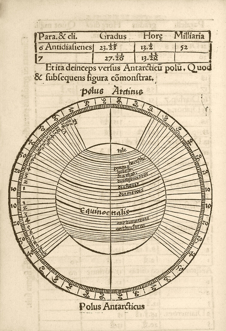
| Parallels on Earth globe. 16th-century diagram of the parallels (lines of latitude) on an Earth globe,showing the Equator and the Arctic and Antarctic poles,and bands called 'climates'. At top are figures for the anti-climate for Syene (Aswan in Egypt). This diagram is from 'Cosmographiae introductio' (1507),printed to accompany the globe and world map produced in 1507 by German cartographer Martin Waldseemuller (c.1470-1520). This 1507 map and booklet contained the first use of the name America to refer to the New World,proposed in honour of the supposed discoverer of the continent,Amerigo Vespucci. The text is in Latin | |
| Lizenzart: | Lizenzpflichtig |
| Credit: | Science Photo Library / Library of Congress |
| Bildgröße: | 2470 px × 3602 px |
| Modell-Rechte: | nicht erforderlich |
| Eigentums-Rechte: | nicht erforderlich |
| Restrictions: | - |
Preise für dieses Bild ab 15 €
Universitäten & Organisationen
(Informationsmaterial Digital, Informationsmaterial Print, Lehrmaterial Digital etc.)
ab 15 €
Redaktionell
(Bücher, Bücher: Sach- und Fachliteratur, Digitale Medien (redaktionell) etc.)
ab 30 €
Werbung
(Anzeigen, Aussenwerbung, Digitale Medien, Fernsehwerbung, Karten, Werbemittel, Zeitschriften etc.)
ab 55 €
Handelsprodukte
(bedruckte Textilie, Kalender, Postkarte, Grußkarte, Verpackung etc.)
ab 75 €
Pauschalpreise
Rechtepakete für die unbeschränkte Bildnutzung in Print oder Online
ab 495 €
Keywords
- 1500er Jahre,
- 16. Jahrhundert,
- Alexandria,
- Amerika,
- Antarktis,
- Äquator,
- Arktis,
- Assuan,
- Bands,
- Blatt,
- Buch,
- Cosmographiae introductio,
- Diagramm,
- Einfarbig,
- Entdeckung,
- Erde,
- Erkundung,
- geografisch,
- Geographie,
- Geschichte,
- Globus,
- historisch,
- Illustration,
- Karte,
- Kartographie,
- Kunstwerk,
- Latein,
- Linie,
- Niemand,
- Norden,
- Parallel,
- Planet,
- Pole,
- Rhodos,
- Rom,
- Schwarz und weiß,
- Süden,
- Text,
- Veröffentlichung