Cannibal legends in Brazil,16th century
Bildnummer 11727759
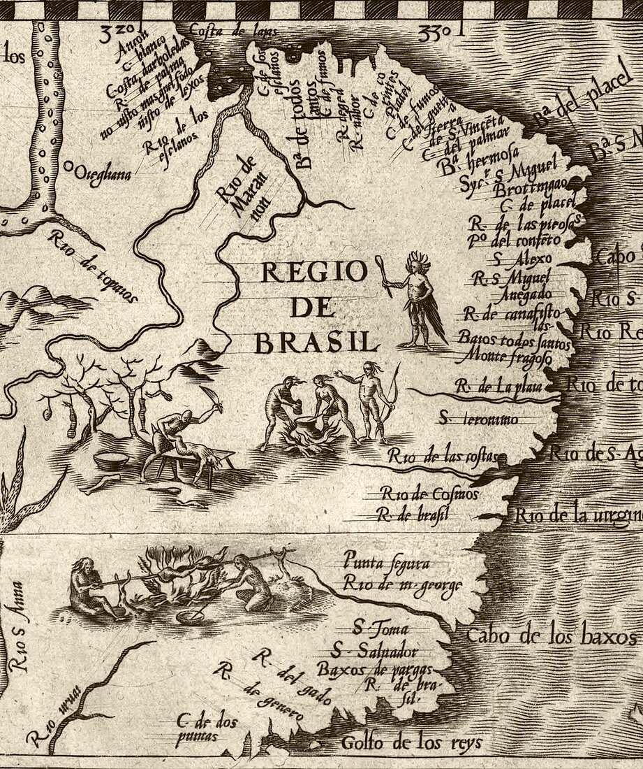
| Cannibal legends in Brazil. 16th-century map showing European legends about cannibals dismembering and cooking humans in a region of Brazil. The Amazon is partly visible at top left,with the rivers at upper left being the Araguaia and Tocantins. Numerous other rivers are labelled along the Atlantic coastline,southwards to the area marked 'Golfo de los reys',where modern-day Rio de Janeiro is located. This image was cropped from a map of America produced by the Spanish cartographer Diego Gutierrez in 1562. This map,'Americae sive qvartae orbis partis nova et exactissima descriptio',was engraved by the Flemish artist Hieronymous Cock | |
| Lizenzart: | Lizenzpflichtig |
| Credit: | Science Photo Library / LIBRARY OF CONGRESS, Geography and Map Division |
| Bildgröße: | 2740 px × 3272 px |
| Modell-Rechte: | nicht erforderlich |
| Eigentums-Rechte: | nicht erforderlich |
| Restrictions: | - |
Preise für dieses Bild ab 15 €
Universitäten & Organisationen
(Informationsmaterial Digital, Informationsmaterial Print, Lehrmaterial Digital etc.)
ab 15 €
Redaktionell
(Bücher, Bücher: Sach- und Fachliteratur, Digitale Medien (redaktionell) etc.)
ab 30 €
Werbung
(Anzeigen, Aussenwerbung, Digitale Medien, Fernsehwerbung, Karten, Werbemittel, Zeitschriften etc.)
ab 55 €
Handelsprodukte
(bedruckte Textilie, Kalender, Postkarte, Grußkarte, Verpackung etc.)
ab 75 €
Pauschalpreise
Rechtepakete für die unbeschränkte Bildnutzung in Print oder Online
ab 495 €
Keywords
- 1500er Jahre,
- 16. Jahrhundert,
- Anthropologie,
- anthropologisch,
- Brasilianer,
- Brasilien,
- Dschungel,
- Einfarbig,
- Erwachsene,
- Essen,
- ethnisch,
- Feuer,
- Frau,
- geografisch,
- Geographie,
- Geschichte,
- historisch,
- Illustration,
- Karte,
- Kartographie,
- Kochen,
- Kochtopf,
- Kunstwerk,
- Lateinamerika,
- Lebensmittel,
- Legende,
- Mann,
- Männlich,
- Mensch,
- Menschen,
- Messer,
- Niemand,
- Person,
- Portugiesisch,
- Regenwald,
- Rio De Janeiro,
- Schwarz und weiß,
- spanisch,
- Südamerika,
- Südamerikanisch,
- Tötung,
- tribal,
- Weiblich