Map of the Elbe River,17th century
Bildnummer 11727758
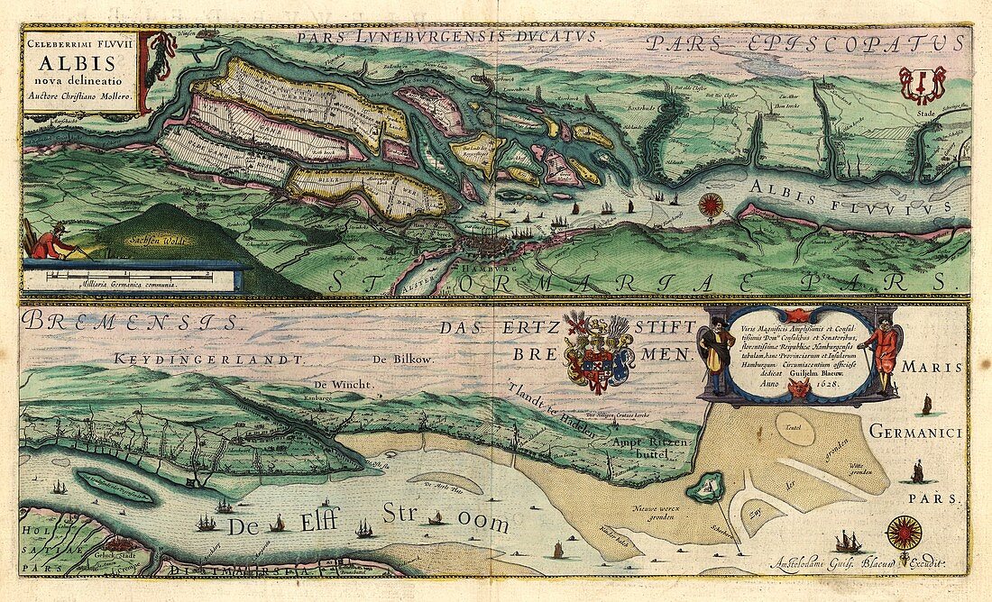
| Map of the Elbe River. 17th-century illustrated map of part of the Elbe River near Hamburg,Germany. Hamburg is shown at upper centre. The Elbe River flows for over 1000 kilometres from its source to its mouth in the North Sea near Hamburg. This map is illustrated with coats-of-arms and pictures of cities,ships,hills,islands and other geographical features. The text annotations and inscriptions are in Latin. This map is from 'Le theatre du monde' or 'Novvel atlas' (Amsterdam,1647) by Dutch map-makers Willem Janszoon Blaeu (1571-1638) and Joan Blaeu (1596-1673) | |
| Lizenzart: | Lizenzpflichtig |
| Credit: | Science Photo Library / LIBRARY OF CONGRESS, Geography and Map Division |
| Bildgröße: | 5640 px × 3425 px |
| Modell-Rechte: | nicht erforderlich |
| Eigentums-Rechte: | nicht erforderlich |
| Restrictions: | - |
Preise für dieses Bild ab 15 €
Universitäten & Organisationen
(Informationsmaterial Digital, Informationsmaterial Print, Lehrmaterial Digital etc.)
ab 15 €
Redaktionell
(Bücher, Bücher: Sach- und Fachliteratur, Digitale Medien (redaktionell) etc.)
ab 30 €
Werbung
(Anzeigen, Aussenwerbung, Digitale Medien, Fernsehwerbung, Karten, Werbemittel, Zeitschriften etc.)
ab 55 €
Handelsprodukte
(bedruckte Textilie, Kalender, Postkarte, Grußkarte, Verpackung etc.)
ab 75 €
Pauschalpreise
Rechtepakete für die unbeschränkte Bildnutzung in Print oder Online
ab 495 €
Keywords
- 1600er Jahre,
- 17. Jahrhundert,
- beschriftet,
- Delta,
- Deutschland,
- Etiketten,
- Europa,
- europäisch,
- Fluss,
- geografisch,
- Geographie,
- Geschichte,
- Hamburg,
- historisch,
- Hydrologie,
- Illustration,
- illustriert,
- Inschrift,
- Joan Blaeu,
- Karte,
- Kunstwerk,
- Latein,
- Niederländisch,
- Niemand,
- Nordsee,
- Stadt,
- Text,
- Wappen