Map of Lima,Peru,17th century
Bildnummer 11727714
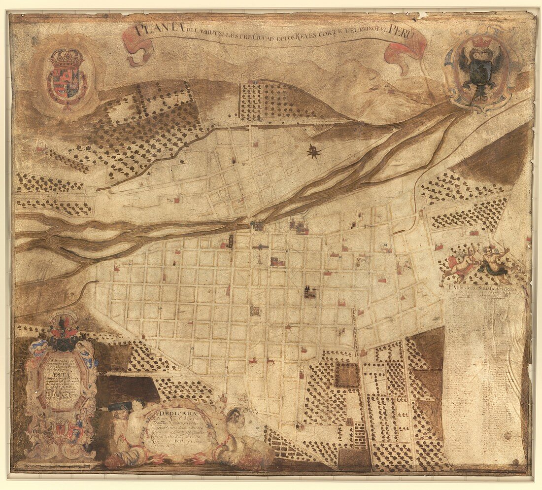
| Map of Lima. 17th-century map of the street plan of Lima,Peru. The inscription at lower left refers to the founding of the city by the Spanish in 1535 and refers to Charles V,the Holy Roman Emperor (Charles I of Spain). It was founded in the Rimac valley as 'Ciudad de los Reyes' (City of the Kings) following the conquest of the Incas by Francisco Pizarro. The Rimac River runs across upper centre. The map title (in Castilian Spanish) is: 'Planta de la muy yllustre ciudad de los reyes corte del reino del Peru'. The map dates from 1674 (before the Walls of Lima were built between 1684 and 1687),and was drawn for the merchant Bernardo Clemente Principe | |
| Lizenzart: | Lizenzpflichtig |
| Credit: | Science Photo Library / LIBRARY OF CONGRESS, Geography and Map Division |
| Bildgröße: | 4837 px × 4371 px |
| Modell-Rechte: | nicht erforderlich |
| Eigentums-Rechte: | nicht erforderlich |
| Restrictions: | - |
Preise für dieses Bild ab 15 €
Universitäten & Organisationen
(Informationsmaterial Digital, Informationsmaterial Print, Lehrmaterial Digital etc.)
ab 15 €
Redaktionell
(Bücher, Bücher: Sach- und Fachliteratur, Digitale Medien (redaktionell) etc.)
ab 30 €
Werbung
(Anzeigen, Aussenwerbung, Digitale Medien, Fernsehwerbung, Karten, Werbemittel, Zeitschriften etc.)
ab 55 €
Handelsprodukte
(bedruckte Textilie, Kalender, Postkarte, Grußkarte, Verpackung etc.)
ab 75 €
Pauschalpreise
Rechtepakete für die unbeschränkte Bildnutzung in Print oder Online
ab 495 €
Keywords
- 1600er Jahre,
- 17. Jahrhundert,
- beschriftet,
- Einfarbig,
- Etikette,
- Etiketten,
- geografisch,
- Geographie,
- Geschichte,
- historisch,
- Illustration,
- Inschrift,
- Karte,
- Kartographie,
- Kunstwerk,
- Lateinamerika,
- menschliche Geografie,
- Niemand,
- Peru,
- Peruanisch,
- spanisch,
- Stadt,
- städtisch,
- Südamerika,
- Südamerikanisch,
- Text