Map of the Dnieper River,17th century
Bildnummer 11727708
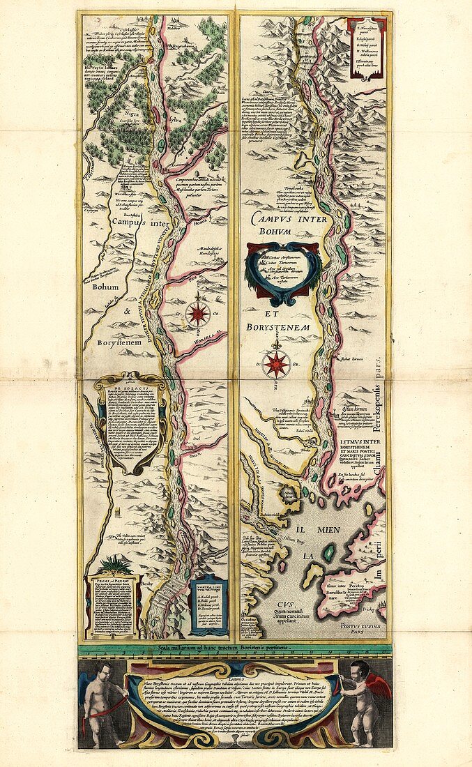
| Map of the Dnieper River. 17th-century illustrated map of the lower reaches of the Dnieper River in what is now Ukraine. This is one of the major rivers of Europe,flowing over 2000 kilometres from its source in Russia to its delta on the Black Sea coast. This map is illustrated with pictures of hills,trees and tributaries. The text is in Latin,with winged putti at bottom holding a banner inscription. This map is from 'Le theatre du monde' or 'Novvel atlas' (Amsterdam,1647) by Dutch map-makers Willem Janszoon Blaeu (1571-1638) and Joan Blaeu (1596-1673) | |
| Lizenzart: | Lizenzpflichtig |
| Credit: | Science Photo Library / LIBRARY OF CONGRESS, Geography and Map Division |
| Bildgröße: | 3603 px × 5855 px |
| Modell-Rechte: | nicht erforderlich |
| Eigentums-Rechte: | nicht erforderlich |
| Restrictions: | - |
Preise für dieses Bild ab 15 €
Universitäten & Organisationen
(Informationsmaterial Digital, Informationsmaterial Print, Lehrmaterial Digital etc.)
ab 15 €
Redaktionell
(Bücher, Bücher: Sach- und Fachliteratur, Digitale Medien (redaktionell) etc.)
ab 30 €
Werbung
(Anzeigen, Aussenwerbung, Digitale Medien, Fernsehwerbung, Karten, Werbemittel, Zeitschriften etc.)
ab 55 €
Handelsprodukte
(bedruckte Textilie, Kalender, Postkarte, Grußkarte, Verpackung etc.)
ab 75 €
Pauschalpreise
Rechtepakete für die unbeschränkte Bildnutzung in Print oder Online
ab 495 €