Korean world map,19th century
Bildnummer 11727683
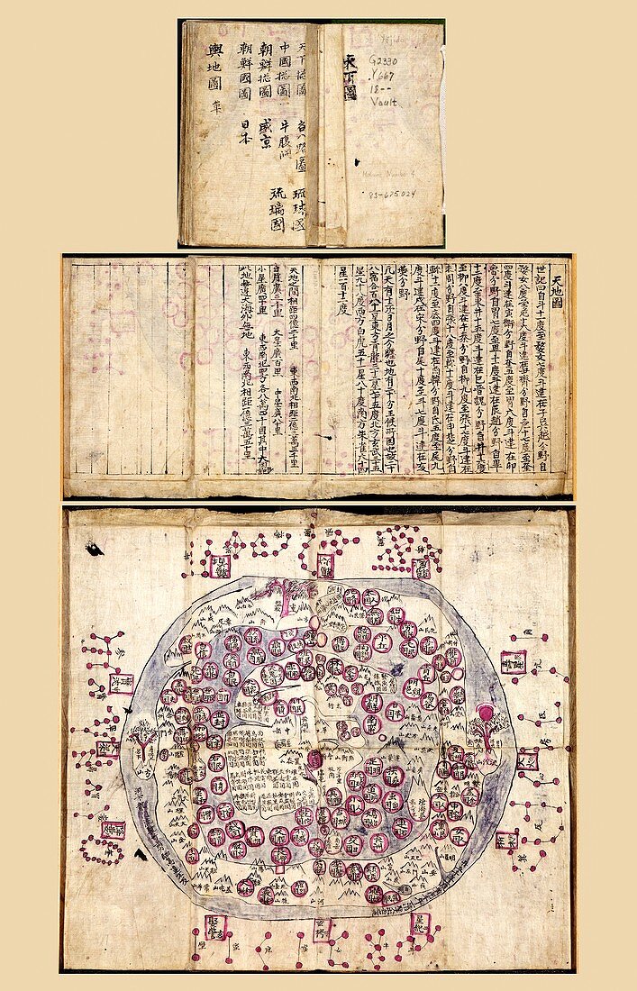
| Korean world map. 19th-century manuscript and map of the world from an atlas of Korean maps. This traditional depiction,called 'Chonhado' (Map of the World),shows the Korean belief that the Earth was flat. The form and circular shape of such Korean maps were largely unchanged from the earliest known examples in the 16th century. The main features were an internal continent surrounded by a sea,with an external continent and sea around the edge. The names and descriptions of places would include references to the religious philosophy of Taoism. This map is from the 19th-century atlas 'Yojido'. For the map alone,see image C026/8523 | |
| Lizenzart: | Lizenzpflichtig |
| Credit: | Science Photo Library / LIBRARY OF CONGRESS, Geography and Map Division |
| Bildgröße: | 3699 px × 5754 px |
| Modell-Rechte: | nicht erforderlich |
| Eigentums-Rechte: | nicht erforderlich |
| Restrictions: | - |
Preise für dieses Bild ab 15 €
Universitäten & Organisationen
(Informationsmaterial Digital, Informationsmaterial Print, Lehrmaterial Digital etc.)
ab 15 €
Redaktionell
(Bücher, Bücher: Sach- und Fachliteratur, Digitale Medien (redaktionell) etc.)
ab 30 €
Werbung
(Anzeigen, Aussenwerbung, Digitale Medien, Fernsehwerbung, Karten, Werbemittel, Zeitschriften etc.)
ab 55 €
Handelsprodukte
(bedruckte Textilie, Kalender, Postkarte, Grußkarte, Verpackung etc.)
ab 75 €
Pauschalpreise
Rechtepakete für die unbeschränkte Bildnutzung in Print oder Online
ab 495 €
Keywords
- 1800er Jahre,
- 19. Jahrhundert,
- Asiatisch,
- Asien,
- beschriftet,
- Blatt,
- Buch,
- Erde,
- Etiketten,
- geografisch,
- Geographie,
- Geschichte,
- historisch,
- Illustration,
- innere,
- Karte,
- Kontinente,
- Korea,
- Koreanisch,
- kreisförmig,
- Kunstwerk,
- Manuskript,
- Meer,
- Niemand,
- orientalisch,
- religiös,
- Ring,
- Schreiben,
- Skript,
- Text,
- Traditionell,
- Veröffentlichung,
- Welt,
- Weltkarte,
- Weltozean,
- zentral