Global botanical geography,1840s
Bildnummer 11727679
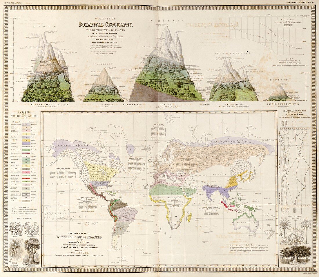
| Global botanical geography. 19th-century botanical maps and illustrations depicting the distribution and variation in plant types and habitats worldwide. Across top are the variations on mountains at different latitudes: the Andes,Tenerife,the Himalayas,the Alps and Pyrenees,and Lapland (see C026/8519). The main world map is colour-coded for 25 different regions (key at left). A graph of statistics of plant families is at right. This work,by Scottish geographer Alexander Keith Johnston (1804-1871),was based on work by German geographers Alexander von Humboldt and Heinrich Berghaus. It was published in 'The Physical Atlas' (1848) | |
| Lizenzart: | Lizenzpflichtig |
| Credit: | Science Photo Library / LIBRARY OF CONGRESS, Geography and Map Division |
| Bildgröße: | 4928 px × 4287 px |
| Modell-Rechte: | nicht erforderlich |
| Eigentums-Rechte: | nicht erforderlich |
| Restrictions: | - |
Preise für dieses Bild ab 15 €
Universitäten & Organisationen
(Informationsmaterial Digital, Informationsmaterial Print, Lehrmaterial Digital etc.)
ab 15 €
Redaktionell
(Bücher, Bücher: Sach- und Fachliteratur, Digitale Medien (redaktionell) etc.)
ab 30 €
Werbung
(Anzeigen, Aussenwerbung, Digitale Medien, Fernsehwerbung, Karten, Werbemittel, Zeitschriften etc.)
ab 55 €
Handelsprodukte
(bedruckte Textilie, Kalender, Postkarte, Grußkarte, Verpackung etc.)
ab 75 €
Pauschalpreise
Rechtepakete für die unbeschränkte Bildnutzung in Print oder Online
ab 495 €
Keywords
- 1800er Jahre,
- 19. Jahrhundert,
- Alexander von Humboldt,
- Alpen,
- Anden,
- Bäume,
- Berg,
- Berge,
- beschriftet,
- Blatt,
- Botanik,
- Buch,
- Distribution,
- Erica,
- Etiketten,
- Flora,
- geografisch,
- Geographie,
- Geschichte,
- Himalaya,
- historisch,
- Illustration,
- Karte,
- Kartographie,
- Kiefern,
- Kunstwerk,
- Lappland,
- Lebensraum,
- Lebensräume,
- Monocots,
- Natur,
- Niemand,
- Ökologie,
- Ökologisch,
- Palmen,
- Pflanze,
- Pflanzen,
- Pinus,
- polar,
- Pyrenäen,
- Schreiben,
- temperent,
- Text,
- Tropisch,
- Veröffentlichung,
- Welt,
- weltweit,
- Zonen