North American pipelines map
Bildnummer 11723794
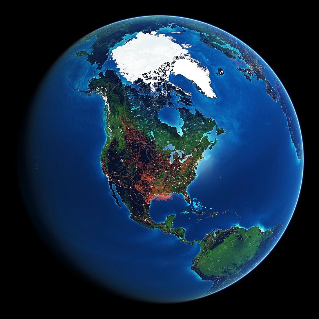
| Earth globe and map showing current and proposed pipelines (red) for oil and gas in North America as of October 2014 and forest coverage (green). Pipelines carry oil and gas between wells,refineries,end use points and export points. The pipeline data for this image was compiled by The FracTracker Alliance. Forest data from the Global Forest Change dataset from Landsat 7's Enhanced Thematic Mapper Plus (ETM+) | |
| Lizenzart: | Lizenzpflichtig |
| Credit: | Science Photo Library / Pharand-Deschenes, Felix |
| Bildgröße: | 5126 px × 5126 px |
| Modell-Rechte: | nicht erforderlich |
| Eigentums-Rechte: | nicht erforderlich |
| Restrictions: | - |
Preise für dieses Bild ab 15 €
Universitäten & Organisationen
(Informationsmaterial Digital, Informationsmaterial Print, Lehrmaterial Digital etc.)
ab 15 €
Redaktionell
(Bücher, Bücher: Sach- und Fachliteratur, Digitale Medien (redaktionell) etc.)
ab 30 €
Werbung
(Anzeigen, Aussenwerbung, Digitale Medien, Fernsehwerbung, Karten, Werbemittel, Zeitschriften etc.)
ab 55 €
Handelsprodukte
(bedruckte Textilie, Kalender, Postkarte, Grußkarte, Verpackung etc.)
ab 75 €
Pauschalpreise
Rechtepakete für die unbeschränkte Bildnutzung in Print oder Online
ab 495 €
Keywords
- 2000er Jahre,
- 2014,
- 21. Jahrhundert,
- Alaska,
- Amerikanisch,
- ausgeschnitten,
- Ausschnitte,
- Distribution,
- Energie,
- Erde,
- Erdkunde,
- Gas,
- geografisch,
- Geographie,
- Globus,
- Illustration,
- Industrie,
- Industriell,
- Kanada,
- Kanadisch,
- Karte,
- Kunstwerk,
- Niemand,
- Nordamerika,
- Öl,
- Pipeline,
- Planet,
- schwarzer Hintergrund,
- Transport,
- Umweltwissenschaften,
- USA,
- Vegetation,
- Vereinigte Staaten,
- Wald,
- Welt