Impact of global temperature rise
Bildnummer 11723603
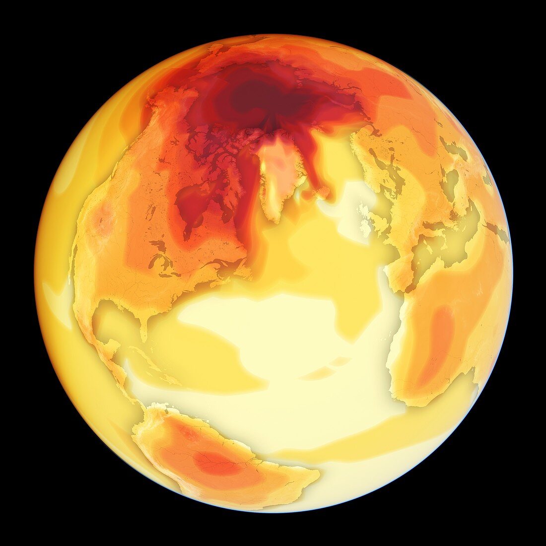
| Earth globe and map centred on the northern Atlantic Ocean showing the impact of an average 4 degree Celsius (C) rise in global temperature on local temperatures. The colour-coding shows temperatures increasing from pale yellow (1 degree C increase),through orange (7 degree C increase) and dark red (11 degrees C increase) to deep burgundy (16 degrees C increase). Oceans will heat more slowly than land. High latitudes,such as the Arctic,will see larger temperature increases than lower latitudes. These increases in temperature will have consequences for public health,agriculture and water availability. Data from the Met Office Hadley Centre for Climate Science and Services | |
| Lizenzart: | Lizenzpflichtig |
| Credit: | Science Photo Library / Pharand-Deschenes, Felix |
| Bildgröße: | 4782 px × 4782 px |
| Modell-Rechte: | nicht erforderlich |
| Eigentums-Rechte: | nicht erforderlich |
| Restrictions: | - |
Preise für dieses Bild ab 15 €
Universitäten & Organisationen
(Informationsmaterial Digital, Informationsmaterial Print, Lehrmaterial Digital etc.)
ab 15 €
Redaktionell
(Bücher, Bücher: Sach- und Fachliteratur, Digitale Medien (redaktionell) etc.)
ab 30 €
Werbung
(Anzeigen, Aussenwerbung, Digitale Medien, Fernsehwerbung, Karten, Werbemittel, Zeitschriften etc.)
ab 55 €
Handelsprodukte
(bedruckte Textilie, Kalender, Postkarte, Grußkarte, Verpackung etc.)
ab 75 €
Pauschalpreise
Rechtepakete für die unbeschränkte Bildnutzung in Print oder Online
ab 495 €
Keywords
- 21. Jahrhundert,
- Arktis,
- Atlantischer Ozean,
- ausgeschnitten,
- Ausschnitte,
- Center,
- Erde,
- Erdkunde,
- Europa,
- europäisch,
- geografisch,
- Geographie,
- Globale Erwärmung,
- Globus,
- Illustration,
- Karte,
- Klimawandel,
- Kunstwerk,
- Niemand,
- Nordamerika,
- nordamerikanisch,
- nördliche Hemisphäre,
- Planet,
- planetarisch,
- schwarzer Hintergrund,
- Umweltwissenschaften,
- Welt,
- weltweit