European population map
Bildnummer 11723061
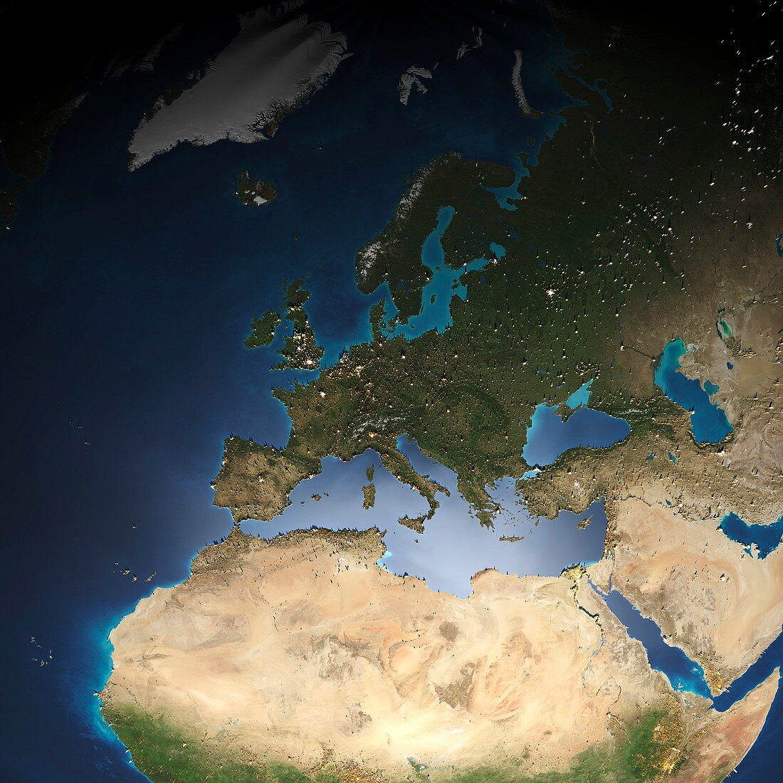
| European population map. Demographic map of population data in Europe and surrounding areas,with the peaks (yellow) showing areas of high population density. The data is based on light pollution and ambient population (data averaged over a 24-hour period) | |
| Lizenzart: | Lizenzpflichtig |
| Credit: | Science Photo Library / Pharand-Deschenes, Felix |
| Bildgröße: | 4185 px × 4185 px |
| Modell-Rechte: | nicht erforderlich |
| Eigentums-Rechte: | nicht erforderlich |
| Restrictions: | - |
Preise für dieses Bild ab 15 €
Universitäten & Organisationen
(Informationsmaterial Digital, Informationsmaterial Print, Lehrmaterial Digital etc.)
ab 15 €
Redaktionell
(Bücher, Bücher: Sach- und Fachliteratur, Digitale Medien (redaktionell) etc.)
ab 30 €
Werbung
(Anzeigen, Aussenwerbung, Digitale Medien, Fernsehwerbung, Karten, Werbemittel, Zeitschriften etc.)
ab 55 €
Handelsprodukte
(bedruckte Textilie, Kalender, Postkarte, Grußkarte, Verpackung etc.)
ab 75 €
Pauschalpreise
Rechtepakete für die unbeschränkte Bildnutzung in Print oder Online
ab 495 €