Northern hemisphere map,1699
Bildnummer 11716799
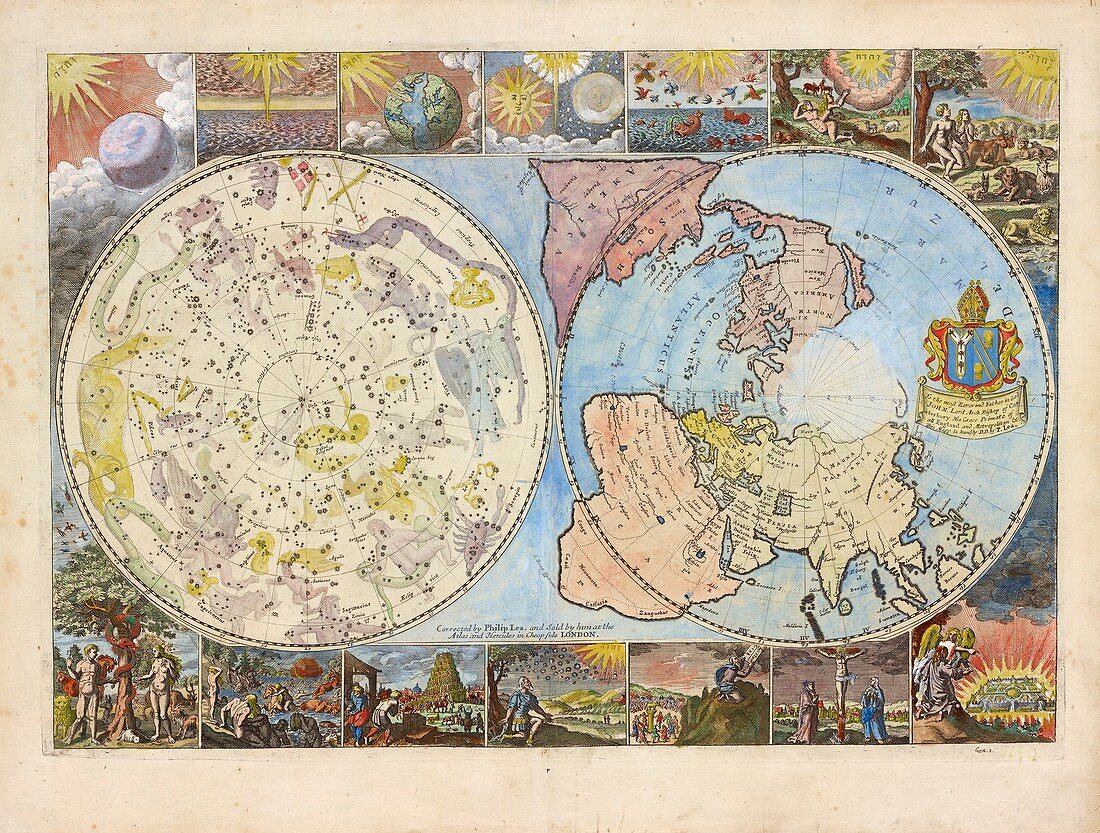
| Map of the northern hemisphere earth and heavens,1699. The celestial map (left) shows stars and drawings of the mythological characters of the constellations. The terrestrial map (right) shows the expanding exploration of the known world. The surrounding panels depict biblical scenes. This map was produced by Philip Lea,a London cartographer,globe and instrument maker. It was published in 1699 and sold at the Atlas and Hercules in Cheapside,London,UK | |
| Lizenzart: | Lizenzpflichtig |
| Credit: | Science Photo Library / NEW YORK PUBLIC LIBRARY / Lionel Pincus and Princess Firyal Map Division |
| Bildgröße: | 5895 px × 4465 px |
| Modell-Rechte: | nicht erforderlich |
| Eigentums-Rechte: | nicht erforderlich |
| Restrictions: | - |
Preise für dieses Bild ab 15 €
Universitäten & Organisationen
(Informationsmaterial Digital, Informationsmaterial Print, Lehrmaterial Digital etc.)
ab 15 €
Redaktionell
(Bücher, Bücher: Sach- und Fachliteratur, Digitale Medien (redaktionell) etc.)
ab 30 €
Werbung
(Anzeigen, Aussenwerbung, Digitale Medien, Fernsehwerbung, Karten, Werbemittel, Zeitschriften etc.)
ab 55 €
Handelsprodukte
(bedruckte Textilie, Kalender, Postkarte, Grußkarte, Verpackung etc.)
ab 75 €
Pauschalpreise
Rechtepakete für die unbeschränkte Bildnutzung in Print oder Online
ab 495 €
Keywords
- 1600er Jahre,
- 17. Jahrhundert,
- Astrologie,
- Astrologisch,
- Astronomie,
- astronomisch,
- Atlas,
- Bekannt,
- Bibel,
- Christentum,
- christlich,
- Erde,
- Erkundung,
- Erweiterung,
- geografisch,
- Geographie,
- Geschichte der Wissenschaft,
- Globus,
- Griechisch,
- Himmel,
- himmlisch,
- historisch,
- Illustration,
- Karte,
- Kartographie,
- Kolonial,
- Kolonie,
- Kolonien,
- Konstellation,
- Kosmologie,
- kosmologisch,
- Kunst,
- Kunstwerk,
- Mythologie,
- Mythologisch,
- Nacht,
- Nachthimmel,
- Nebeneinander,
- Niemand,
- Raum,
- Religion,
- religiös,
- Römisch,
- siebzehntes Jahrhundert,
- Stern,
- Sternbilder,
- Sterne,
- terrestrisch,
- Tierkreis,
- Universum,
- Welt,
- weltweit