Lake Tai,satellite image
Bildnummer 11712966
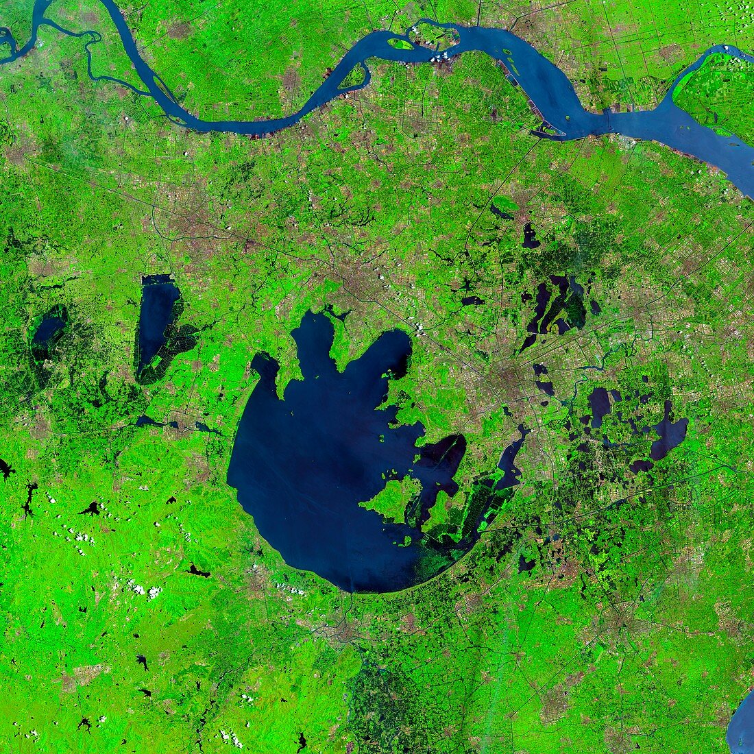
| Lake Tai,China,satellite image. Lake Tai (centre,dark blue),also known as Taihu,is a large freshwater lake near the Yangtse river (at top) and Shanghai in China. It covers an area of 2,250 square kilometres and was formed as a result of water filling a 65 kilometres wide crater from an impact that occured roughly 70 million years ago. Imaged by the Operational Land Imager (OLI) on board the Landsat 8 satellite on 22nd July 2014. The OLI sensor detects wavelengths across 9 spectral bands. This image was created using infrared,red and green spectral bands. It depicts an area measuring 170 kilometres across | |
| Lizenzart: | Lizenzpflichtig |
| Credit: | Science Photo Library / NASA |
| Bildgröße: | 4201 px × 4201 px |
| Modell-Rechte: | nicht erforderlich |
| Eigentums-Rechte: | nicht erforderlich |
| Restrictions: | - |
Preise für dieses Bild ab 15 €
Universitäten & Organisationen
(Informationsmaterial Digital, Informationsmaterial Print, Lehrmaterial Digital etc.)
ab 15 €
Redaktionell
(Bücher, Bücher: Sach- und Fachliteratur, Digitale Medien (redaktionell) etc.)
ab 30 €
Werbung
(Anzeigen, Aussenwerbung, Digitale Medien, Fernsehwerbung, Karten, Werbemittel, Zeitschriften etc.)
ab 55 €
Handelsprodukte
(bedruckte Textilie, Kalender, Postkarte, Grußkarte, Verpackung etc.)
ab 75 €
Pauschalpreise
Rechtepakete für die unbeschränkte Bildnutzung in Print oder Online
ab 495 €