War map of Cologne,Germany
Bildnummer 11711353
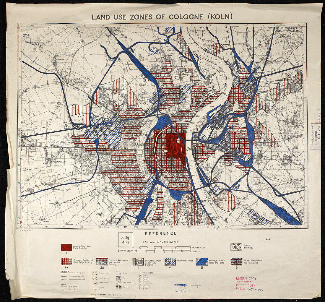
| War map of Cologne. British military map of Cologne,Germany,overprinted to show vulnerability to high explosive and incendiary bombing. Produced by the Great Britain Air Ministry,1943-1944 | |
| Lizenzart: | Lizenzpflichtig |
| Credit: | Science Photo Library / British Library |
| Bildgröße: | 5174 px × 4809 px |
| Modell-Rechte: | nicht erforderlich |
| Eigentums-Rechte: | nicht erforderlich |
| Restrictions: | - |
Preise für dieses Bild ab 15 €
Universitäten & Organisationen
(Informationsmaterial Digital, Informationsmaterial Print, Lehrmaterial Digital etc.)
ab 15 €
Redaktionell
(Bücher, Bücher: Sach- und Fachliteratur, Digitale Medien (redaktionell) etc.)
ab 30 €
Werbung
(Anzeigen, Aussenwerbung, Digitale Medien, Fernsehwerbung, Karten, Werbemittel, Zeitschriften etc.)
ab 55 €
Handelsprodukte
(bedruckte Textilie, Kalender, Postkarte, Grußkarte, Verpackung etc.)
ab 75 €
Pauschalpreise
Rechtepakete für die unbeschränkte Bildnutzung in Print oder Online
ab 495 €
Keywords
- 1900er Jahre,
- 1940,
- 20. Jahrhundert,
- Bombe,
- britisch,
- Deutsche,
- Deutschland,
- Europa,
- europäisch,
- Extrakt,
- Geschichte,
- herabsehend,
- historisch,
- Illustration,
- Karte,
- Kartographie,
- Köln,
- Krieg,
- Kriegsführung,
- Kunstwerk,
- Luftaufnahme,
- Militär-,
- Niemand,
- Stadt,
- städtisch,
- Verletzlichkeit,
- Von Oben,
- ww2,
- wwii,
- Zweiter Weltkrieg