Sentinel-1,illustration
Bildnummer 11711097
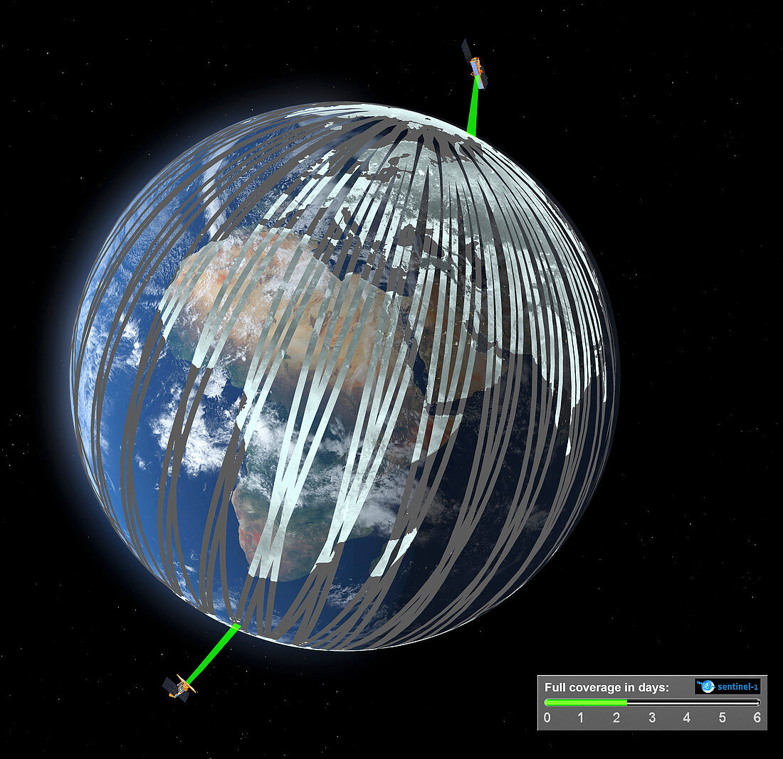
| Sentinel-1. Computer illustration showing the paths (grey) imaged by the Sentinel 1 satellites as they orbit the Earth. Sentinel-1 consists of two satellites orbiting Earth 180 degrees apart. Working together,they offer global revisit every six days. Sentinel-1A was launched in 2014 and Sentinel-1B is scheduled for 2016. The satellites carry an advanced radar instrument to image Earth's surface through cloud and rain,and regardless of whether it is day or night. As such,they will deliver timely information for numerous Copernicus Programme services,from monitoring ice in polar oceans to tracking land subsidence. This new mission is also designed specifically for fast response to aid emergencies and disasters such as flooding and | |
| Lizenzart: | Lizenzpflichtig |
| Credit: | Science Photo Library / ESA / ATG Medialab |
| Bildgröße: | 3074 px × 2982 px |
| Modell-Rechte: | nicht erforderlich |
| Eigentums-Rechte: | nicht erforderlich |
| Restrictions: |
|
Preise für dieses Bild ab 15 €
Universitäten & Organisationen
(Informationsmaterial Digital, Informationsmaterial Print, Lehrmaterial Digital etc.)
ab 15 €
Redaktionell
(Bücher, Bücher: Sach- und Fachliteratur, Digitale Medien (redaktionell) etc.)
ab 30 €
Werbung
(Anzeigen, Aussenwerbung, Digitale Medien, Fernsehwerbung, Karten, Werbemittel, Zeitschriften etc.)
ab 55 €
Handelsprodukte
(bedruckte Textilie, Kalender, Postkarte, Grußkarte, Verpackung etc.)
ab 75 €
Pauschalpreise
Rechtepakete für die unbeschränkte Bildnutzung in Print oder Online
ab 495 €
Keywords
- 1,
- 21. Jahrhundert,
- ausgeschnitten,
- Ausrüstung,
- Ausschnitte,
- Bildgebung,
- Eis,
- Erdbeben,
- Erdbeobachtung,
- Gerät,
- Hilfe,
- Illustration,
- Industriell,
- Information,
- Katastrophe,
- Kunstwerk,
- Maschine,
- Mission,
- NASA,
- Niemand,
- Orbit,
- Pfad,
- Planetenwissenschaft,
- polar,
- Raum,
- Raumfahrzeug,
- Raumschiff,
- Scan,
- Scannen,
- schwarzer Hintergrund,
- Sentinel-1,
- Sentinel-1a,
- Technologie,
- technologisch,
- Überschwemmung,
- umkreisend,
- Umlaufbahnen,
- Umwelt,
- Umweltwissenschaften,
- Wege,
- Weltraumflug