Petermann Glacier,interferogram
Bildnummer 11711087
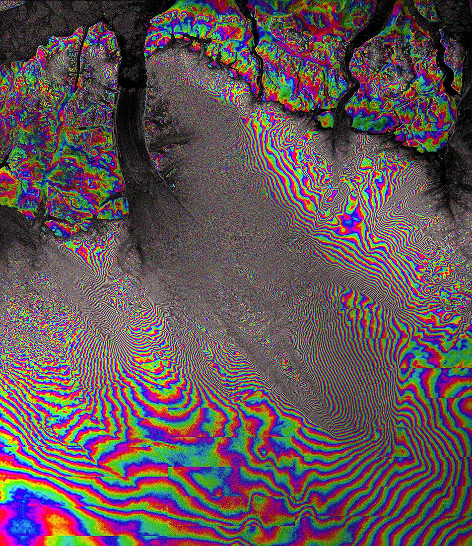
| Petermann Glacier,interferogram. Synthetic aperture radar interferometry (InSAR) image of the Petermann Glacier,Greenland. InSAR is a technique where two or more satellite radar images acquired over the same area are combined to map surface topography and detect surface change/movements. Here it shows the movement of the glacier as it slowly grinds its way towards the sea. The image shows some stationary and relatively slowly moving features,as well as large areas of much faster moving ice. The interferometric fringes are widely spaced in the stationary areas and closer together in the centre of the glacier where the ice is moving much faster. Image produced by combining two Radarsat-2 TOPS images acquired 24 days apart in 2014 | |
| Lizenzart: | Lizenzpflichtig |
| Credit: | Science Photo Library / ESA / MDA |
| Bildgröße: | 1486 px × 1718 px |
| Modell-Rechte: | nicht erforderlich |
| Eigentums-Rechte: | nicht erforderlich |
| Restrictions: |
|
Preise für dieses Bild ab 15 €
Universitäten & Organisationen
(Informationsmaterial Digital, Informationsmaterial Print, Lehrmaterial Digital etc.)
ab 15 €
Redaktionell
(Bücher, Bücher: Sach- und Fachliteratur, Digitale Medien (redaktionell) etc.)
ab 30 €
Werbung
(Anzeigen, Aussenwerbung, Digitale Medien, Fernsehwerbung, Karten, Werbemittel, Zeitschriften etc.)
ab 55 €
Handelsprodukte
(bedruckte Textilie, Kalender, Postkarte, Grußkarte, Verpackung etc.)
ab 75 €
Pauschalpreise
Rechtepakete für die unbeschränkte Bildnutzung in Print oder Online
ab 495 €