Marine gravity map
Bildnummer 11711068
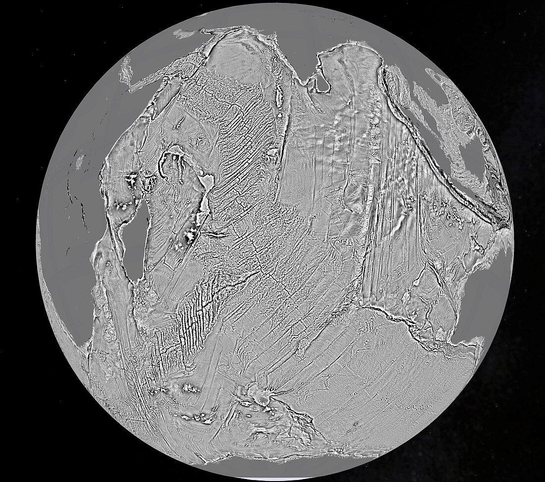
| Marine gravity map. Gravity map centred over the Indian Ocean,showing the features of the seafloor. This map is based on satellite altimetry data measuring sea-surface height that has been used to derive a map of the seafloor. This new map exposes thousands of previously uncharted seamounts,ridges and deep ocean structures. Based on data from the ESA CryoSat mission and the CNES-NASA Jason-1 satellite | |
| Lizenzart: | Lizenzpflichtig |
| Credit: | Science Photo Library / ESA |
| Bildgröße: | 2609 px × 2308 px |
| Modell-Rechte: | nicht erforderlich |
| Eigentums-Rechte: | nicht erforderlich |
| Restrictions: |
|
Preise für dieses Bild ab 15 €
Universitäten & Organisationen
(Informationsmaterial Digital, Informationsmaterial Print, Lehrmaterial Digital etc.)
ab 15 €
Redaktionell
(Bücher, Bücher: Sach- und Fachliteratur, Digitale Medien (redaktionell) etc.)
ab 30 €
Werbung
(Anzeigen, Aussenwerbung, Digitale Medien, Fernsehwerbung, Karten, Werbemittel, Zeitschriften etc.)
ab 55 €
Handelsprodukte
(bedruckte Textilie, Kalender, Postkarte, Grußkarte, Verpackung etc.)
ab 75 €
Pauschalpreise
Rechtepakete für die unbeschränkte Bildnutzung in Print oder Online
ab 495 €
Keywords
- 21. Jahrhundert,
- abgebildet,
- Altimetrie,
- altimetrisch,
- ausgeschnitten,
- Ausschnitte,
- cnes,
- Einfarbig,
- Erdbeobachtung,
- Erde,
- esa,
- geografisch,
- Geologie,
- geologisch,
- Indischer Ozean,
- jason-1,
- Meeresboden,
- NASA,
- Niemand,
- Planetenwissenschaft,
- Satellitenbild,
- schwarz und weiß,
- schwarzer Hintergrund,
- Weltall