Altimeter reading over Cuba
Bildnummer 11711042
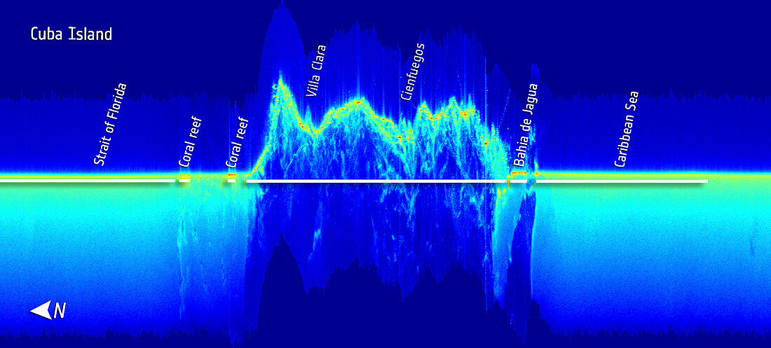
| Altimeter reading over Cuba. Altimetric reading showing the topography of the island of Cuba (centre) compared to the surrounding Caribbean Sea. The image shows radar reflections that differ in intensity between the water and elevated land. Near the edges of the island,points of high radar reflections are pictured in red. This is due to the higher reflectiveness of calm waters of the bay and over coral reefs. Imaged by the CryoSat satellite | |
| Lizenzart: | Lizenzpflichtig |
| Credit: | Science Photo Library / ESA |
| Bildgröße: | 2266 px × 1024 px |
| Modell-Rechte: | nicht erforderlich |
| Eigentums-Rechte: | nicht erforderlich |
| Restrictions: |
|
Preise für dieses Bild ab 15 €
Universitäten & Organisationen
(Informationsmaterial Digital, Informationsmaterial Print, Lehrmaterial Digital etc.)
ab 15 €
Redaktionell
(Bücher, Bücher: Sach- und Fachliteratur, Digitale Medien (redaktionell) etc.)
ab 30 €
Werbung
(Anzeigen, Aussenwerbung, Digitale Medien, Fernsehwerbung, Karten, Werbemittel, Zeitschriften etc.)
ab 55 €
Handelsprodukte
(bedruckte Textilie, Kalender, Postkarte, Grußkarte, Verpackung etc.)
ab 75 €
Pauschalpreise
Rechtepakete für die unbeschränkte Bildnutzung in Print oder Online
ab 495 €
Keywords
- Altimetrie,
- Blau,
- geografisch,
- Geographie,
- Grafik,
- Höhe,
- Insel,
- Karibisches Meer,
- Kuba,
- Kubanisch,
- Lesen,
- Meer,
- Niemand,
- Physik,
- physisch,
- Spur