Nepal earthquake deformation,2015
Bildnummer 11710165
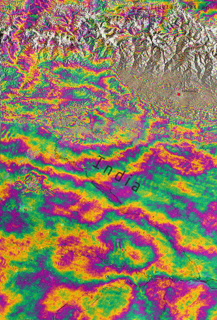
| Nepal earthquake deformation,2015. Satellite radar interferogram showing the ground deformation in the Himalayas,Nepal and northern India,following the earthquake of 25 April 2015. The interferogram is generated from two Sentinel-1A scans obtained on 17 and 29 April 2015,before and after the earthquake. An overall area of 120 by 100 kilometres has moved. Half has been uplifted and the other half,north of Kathmandu (upper right),has subsided. Vertical accuracy is a few centimetres. Sentinel-1A is a European radar imaging satellite launched in 2014. The Nepal earthquake,with a moment magnitude of 7.8,killed more than 7000 people | |
| Lizenzart: | Lizenzpflichtig |
| Credit: | Science Photo Library / EUROPEAN SPACE AGENCY / COMET–ESA SEOM INSARAP / PPO.labs / Norut / Copernicus |
| Bildgröße: | 2419 px × 3560 px |
| Modell-Rechte: | nicht erforderlich |
| Eigentums-Rechte: | nicht erforderlich |
| Restrictions: |
|
Preise für dieses Bild ab 15 €
Universitäten & Organisationen
(Informationsmaterial Digital, Informationsmaterial Print, Lehrmaterial Digital etc.)
ab 15 €
Redaktionell
(Bücher, Bücher: Sach- und Fachliteratur, Digitale Medien (redaktionell) etc.)
ab 30 €
Werbung
(Anzeigen, Aussenwerbung, Digitale Medien, Fernsehwerbung, Karten, Werbemittel, Zeitschriften etc.)
ab 55 €
Handelsprodukte
(bedruckte Textilie, Kalender, Postkarte, Grußkarte, Verpackung etc.)
ab 75 €
Pauschalpreise
Rechtepakete für die unbeschränkte Bildnutzung in Print oder Online
ab 495 €