Nepal earthquake deformation,2015
Bildnummer 11710164
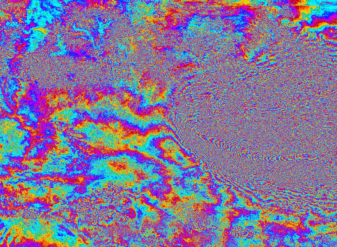
| Nepal earthquake deformation,2015. Satellite radar interferogram showing the ground deformation that occurred around Kathmandu,Nepal (right),following the earthquake of 25 April 2015. The interferogram is generated from two Sentinel-1A scans obtained on 17 and 29 April 2015,before and after the earthquake. Each 'fringe' of colour represents about 3 centimetres of deformation. The large amount of fringes indicates a large deformation pattern with ground motions of 1 metre or more. Sentinel-1A is a European radar imaging satellite launched in 2014. The Nepal earthquake,with a moment magnitude of 7.8,killed more than 7000 people | |
| Lizenzart: | Lizenzpflichtig |
| Credit: | Science Photo Library / EUROPEAN SPACE AGENCY / INGV–ESA SEOM INSARAP / e-GEOS / GFZ / DLR / Copernicus |
| Bildgröße: | 2358 px × 1730 px |
| Modell-Rechte: | nicht erforderlich |
| Eigentums-Rechte: | nicht erforderlich |
| Restrictions: |
|
Preise für dieses Bild ab 15 €
Universitäten & Organisationen
(Informationsmaterial Digital, Informationsmaterial Print, Lehrmaterial Digital etc.)
ab 15 €
Redaktionell
(Bücher, Bücher: Sach- und Fachliteratur, Digitale Medien (redaktionell) etc.)
ab 30 €
Werbung
(Anzeigen, Aussenwerbung, Digitale Medien, Fernsehwerbung, Karten, Werbemittel, Zeitschriften etc.)
ab 55 €
Handelsprodukte
(bedruckte Textilie, Kalender, Postkarte, Grußkarte, Verpackung etc.)
ab 75 €
Pauschalpreise
Rechtepakete für die unbeschränkte Bildnutzung in Print oder Online
ab 495 €