Logging pattern,USA
Bildnummer 11697664
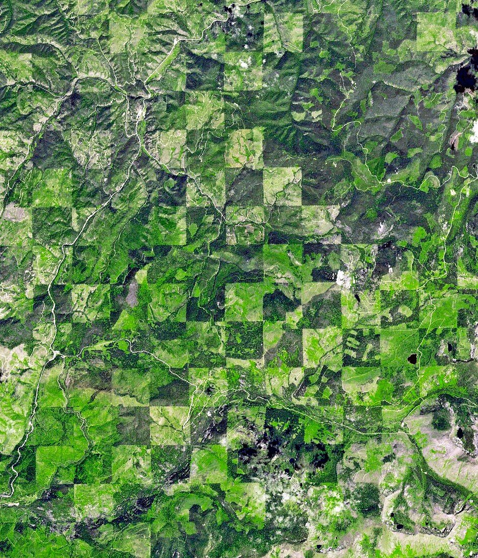
| Logging pattern. Satellite image showing the checkerboard pattern left by logging operations along the Idaho-Montana border,between Clearwater and Bitterroot National Forests,USA. Each 1x1 mile square seen here is harvested at a different time,producing a pattern of varied timber density and re-growth stages. Imaged by the ASTER (Advanced Spaceborne Thermal Emission and Reflection Radiometer) instrument onboard NASA's Terra satellite,on 30th July 2012 | |
| Lizenzart: | Lizenzpflichtig |
| Credit: | Science Photo Library / Japan ASTER Science Team / JAROS, and U.S. / ERSDAC / METI / GSFC / NASA |
| Bildgröße: | 1755 px × 2050 px |
| Modell-Rechte: | nicht erforderlich |
| Eigentums-Rechte: | nicht erforderlich |
| Restrictions: | - |
Preise für dieses Bild ab 15 €
Universitäten & Organisationen
(Informationsmaterial Digital, Informationsmaterial Print, Lehrmaterial Digital etc.)
ab 15 €
Redaktionell
(Bücher, Bücher: Sach- und Fachliteratur, Digitale Medien (redaktionell) etc.)
ab 30 €
Werbung
(Anzeigen, Aussenwerbung, Digitale Medien, Fernsehwerbung, Karten, Werbemittel, Zeitschriften etc.)
ab 55 €
Handelsprodukte
(bedruckte Textilie, Kalender, Postkarte, Grußkarte, Verpackung etc.)
ab 75 €
Pauschalpreise
Rechtepakete für die unbeschränkte Bildnutzung in Print oder Online
ab 495 €
Keywords
- 2012,
- 21. Jahrhundert,
- Amerikanisch,
- Aster,
- Bauholz,
- Bodennutzung,
- Bühne,
- Dichte,
- Erdbeobachtung,
- Gemustert,
- geografisch,
- Geographie,
- Idaho,
- Industrie,
- Industriell,
- Juli,
- Landwirtschaft,
- Montana,
- Muster,
- Niemand,
- Nordamerika,
- Quadrat,
- Quadrate,
- Satellitenbild,
- Schachbrett,
- Stationen,
- Terra satellit,
- uns,
- Vereinigte Staaten,
- Von Oben,
- Wachstum,
- Wald,
- Wälder,
- Weltall