Afar,Ethiopia,satellite image
Bildnummer 11695623
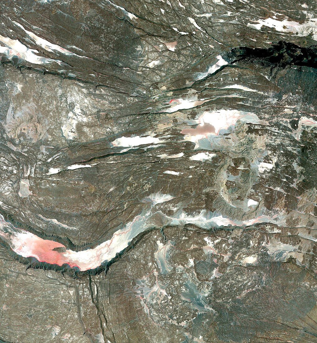
| Infrared satellite image of a section of the Afar triangle in Ethiopia. In this region three tectonic plates are spreading away from each other,causing the numerous cracks seen in the basalt rock (brown). Across lower centre is a graben,a gulley formed by sinking land when the ground either side pulls away. Red areas are vegetation. This region is the site of a number of important hominid fossil discoveries. Image obtained by the Advanced Spaceborne Thermal Emission and Reflection Radiometer (ASTER) on NASA's Terra satellite | |
| Lizenzart: | Lizenzpflichtig |
| Credit: | Science Photo Library / Japan ASTER Science Team / JAROS, and U.S. / ERSDAC / METI / GSFC / NASA |
| Bildgröße: | 4027 px × 4358 px |
| Modell-Rechte: | nicht erforderlich |
| Eigentums-Rechte: | nicht erforderlich |
| Restrictions: | - |
Preise für dieses Bild ab 15 €
Universitäten & Organisationen
(Informationsmaterial Digital, Informationsmaterial Print, Lehrmaterial Digital etc.)
ab 15 €
Redaktionell
(Bücher, Bücher: Sach- und Fachliteratur, Digitale Medien (redaktionell) etc.)
ab 30 €
Werbung
(Anzeigen, Aussenwerbung, Digitale Medien, Fernsehwerbung, Karten, Werbemittel, Zeitschriften etc.)
ab 55 €
Handelsprodukte
(bedruckte Textilie, Kalender, Postkarte, Grußkarte, Verpackung etc.)
ab 75 €
Pauschalpreise
Rechtepakete für die unbeschränkte Bildnutzung in Print oder Online
ab 495 €