Mount Tambora,Indonesia,satellite image
Bildnummer 11694575
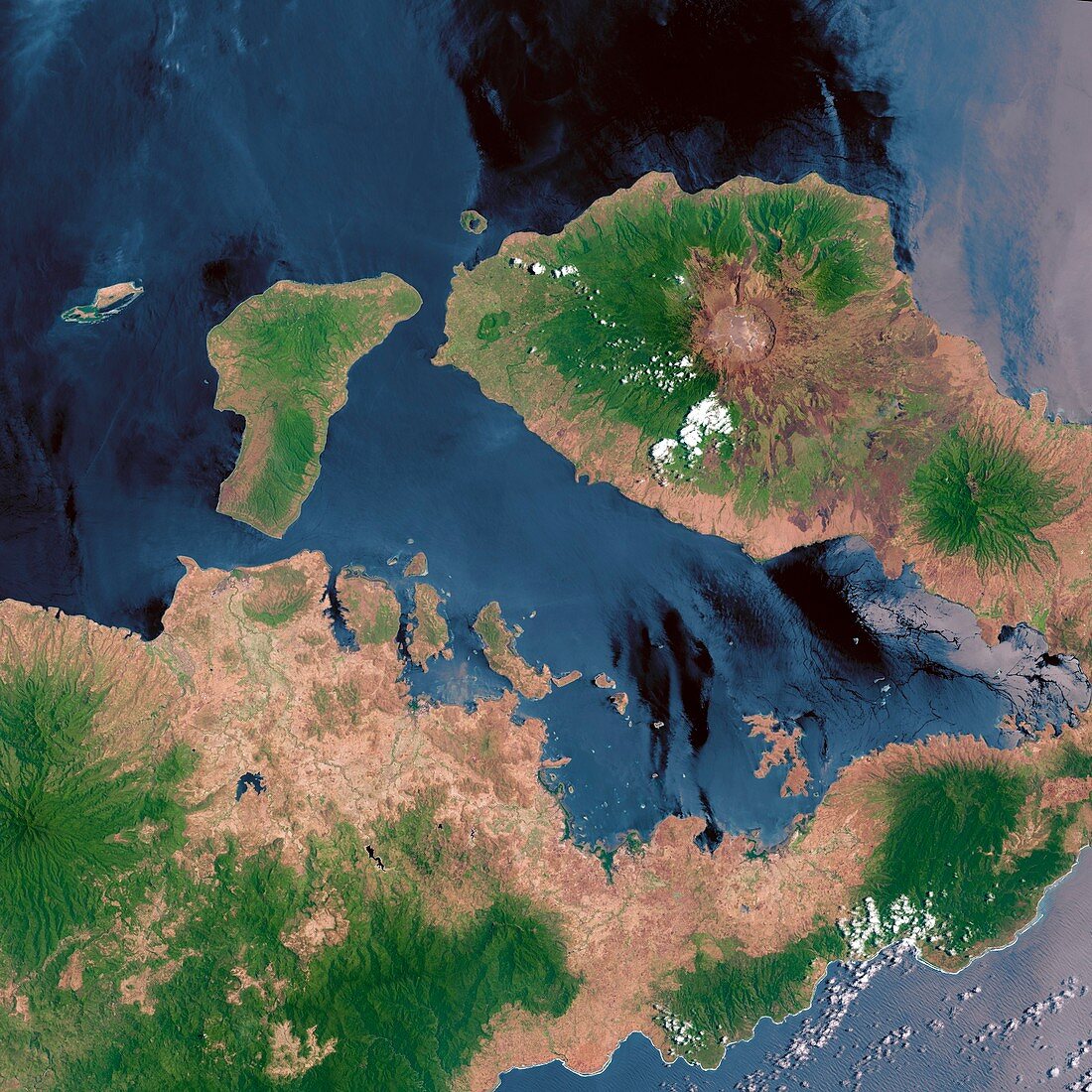
| Mount Tambora. Landsat 8 satellite imageof Mount Tambora volcano (upper right),Sumbawa Island,Indonesia. The volcano's caldera (brown circle),an area of collapsed land resulting from a volcanic eruption,measures 6 kilometres across and is 800 metres deep. The caldera was formed in 1815 after a huge explosion that ejected massive amounts of ash and sulphur dioxide into the atmosphere. Global cooling caused by the eruption led to 1816 being called 'the year without a summer'. Image obtained by Landsat 8's Operational Land Imager (OLI),in October 2013 | |
| Lizenzart: | Lizenzpflichtig |
| Credit: | Science Photo Library / US Geological Survey |
| Bildgröße: | 4206 px × 4206 px |
| Modell-Rechte: | nicht erforderlich |
| Eigentums-Rechte: | nicht erforderlich |
| Restrictions: | - |
Preise für dieses Bild ab 15 €
Universitäten & Organisationen
(Informationsmaterial Digital, Informationsmaterial Print, Lehrmaterial Digital etc.)
ab 15 €
Redaktionell
(Bücher, Bücher: Sach- und Fachliteratur, Digitale Medien (redaktionell) etc.)
ab 30 €
Werbung
(Anzeigen, Aussenwerbung, Digitale Medien, Fernsehwerbung, Karten, Werbemittel, Zeitschriften etc.)
ab 55 €
Handelsprodukte
(bedruckte Textilie, Kalender, Postkarte, Grußkarte, Verpackung etc.)
ab 75 €
Pauschalpreise
Rechtepakete für die unbeschränkte Bildnutzung in Print oder Online
ab 495 €