Nishinoshima volcanic eruption,Landsat 8
Bildnummer 11690156
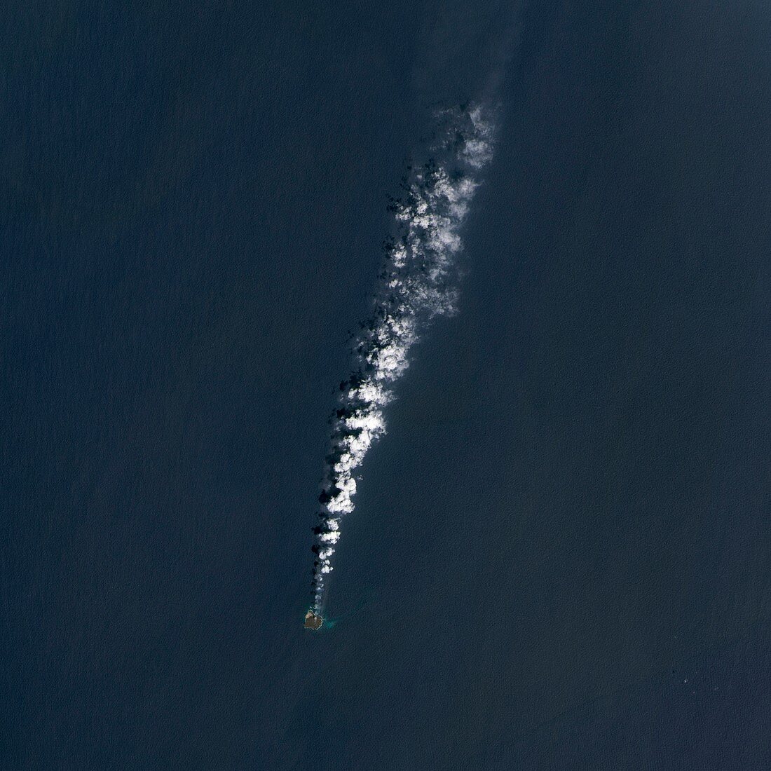
| Nishinoshima volcanic eruption. Satellite image of ash-seeded clouds (white) and the ash plume from the volcanic eruption expanding the Pacific island of Nishinoshima (bottom),south-east of Japan. North is at top. Prior to eruptions in 1973-74,this island was the peak of an underwater volcano that had not erupted for over 10,000 years. The eruption of November 2013 created a new island to the south-east. By 30 March 2014 the islands had merged and grown to around a kilometre across (the original island was around 500 metres across). Image data obtained on 30 March 2014 by the Operational Land Imager (OLI) on the Landsat 8 satellite | |
| Lizenzart: | Lizenzpflichtig |
| Credit: | Science Photo Library / NASA Earth Observatory |
| Bildgröße: | 4181 px × 4181 px |
| Modell-Rechte: | nicht erforderlich |
| Eigentums-Rechte: | nicht erforderlich |
| Restrictions: | - |
Preise für dieses Bild ab 15 €
Universitäten & Organisationen
(Informationsmaterial Digital, Informationsmaterial Print, Lehrmaterial Digital etc.)
ab 15 €
Redaktionell
(Bücher, Bücher: Sach- und Fachliteratur, Digitale Medien (redaktionell) etc.)
ab 30 €
Werbung
(Anzeigen, Aussenwerbung, Digitale Medien, Fernsehwerbung, Karten, Werbemittel, Zeitschriften etc.)
ab 55 €
Handelsprodukte
(bedruckte Textilie, Kalender, Postkarte, Grußkarte, Verpackung etc.)
ab 75 €
Pauschalpreise
Rechtepakete für die unbeschränkte Bildnutzung in Print oder Online
ab 495 €
Keywords
- 2014,
- 21. Jahrhundert,
- Asche,
- Bildung,
- einer,
- Erdbeobachtung,
- Erdkunde,
- Formation,
- geografisch,
- Geographie,
- Geologie,
- geologisch,
- Gipfel,
- Insel,
- Japanisch,
- Landsat 8,
- Meer,
- NASA,
- Neu,
- neues Land,
- Niemand,
- Oberfläche,
- oli,
- Ozeanien,
- Pazifik,
- Plume,
- Satellit,
- Satellitenbild,
- Single,
- Unterwasservulkan,
- Vulkan,
- vulkanisch,
- Vulkanologie,
- Wachsen,
- wachsend,
- Weltall,
- Wolken