Warsaw in 2013,Landsat 8 image
Bildnummer 11690145
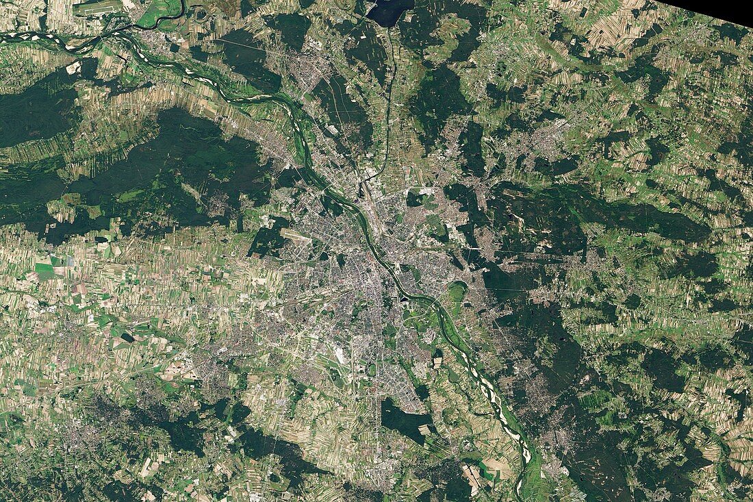
| Warsaw in 2013. Satellite image of Warsaw,the capital city of Poland,and its surroundings. North is at top. The city is at centre,on the Vistula River,while surrounding it here are various suburbs that make up the Warsaw metropolitan area. The surrounding land also includes agricultural fields and forests. The city of Warsaw itself covers an area of 517 square kilometres,while the Warsaw metropolitan area covers 3000 square kilometres. As of 2013,the metropolitan area had a population of 2.66 million people. Image data obtained on 8 September 2013 by the Operational Land Imager (OLI) on the Landsat 8 satellite | |
| Lizenzart: | Lizenzpflichtig |
| Credit: | Science Photo Library / NASA Earth Observatory |
| Bildgröße: | 5120 px × 3413 px |
| Modell-Rechte: | nicht erforderlich |
| Eigentums-Rechte: | nicht erforderlich |
| Restrictions: | - |
Preise für dieses Bild ab 15 €
Universitäten & Organisationen
(Informationsmaterial Digital, Informationsmaterial Print, Lehrmaterial Digital etc.)
ab 15 €
Redaktionell
(Bücher, Bücher: Sach- und Fachliteratur, Digitale Medien (redaktionell) etc.)
ab 30 €
Werbung
(Anzeigen, Aussenwerbung, Digitale Medien, Fernsehwerbung, Karten, Werbemittel, Zeitschriften etc.)
ab 55 €
Handelsprodukte
(bedruckte Textilie, Kalender, Postkarte, Grußkarte, Verpackung etc.)
ab 75 €
Pauschalpreise
Rechtepakete für die unbeschränkte Bildnutzung in Print oder Online
ab 495 €
Keywords
- 2013,
- 21. Jahrhundert,
- Ackerland,
- Erdbeobachtung,
- Europa,
- europäisch,
- Felder,
- Fluss,
- geografisch,
- Geographie,
- Hauptstadt,
- Land,
- Landsat 8,
- landwirtschaftlich,
- menschliche Geografie,
- Niemand,
- oli,
- Polen,
- Polieren,
- Satellit,
- Satellitenbild,
- Stadt,
- städtisch,
- Tal,
- Wald,
- Wälder,
- Weichsel,
- Weltall,
- zentral