Fish River Canyon,Namibia
Bildnummer 11682492
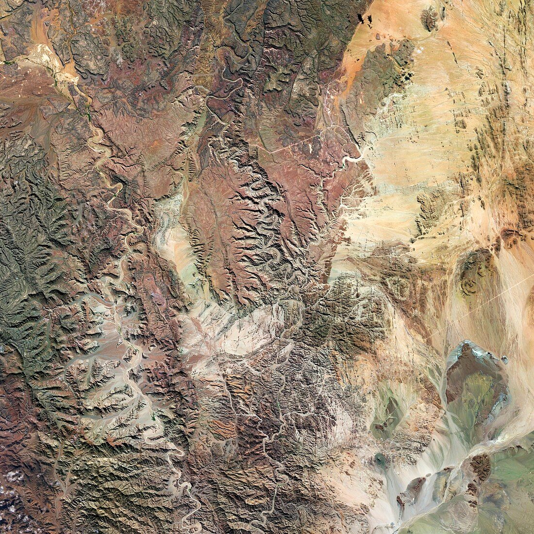
| Fish River Canyon,Namibia,satellite image. This canyon was initially formed by tectonic activity and glacier action millions of years ago before being carved by the eroding action of the Fish River. It measures 161 kilometres in length,27 kilometres wide and 550 metres at its deepest. Image taken in April 2014 by the OLI (Operational Land Imager) on board the Landsat 8 space satellite. This image covers an area measuring 79 kilometres squared | |
| Lizenzart: | Lizenzpflichtig |
| Credit: | Science Photo Library / US Geological Survey |
| Bildgröße: | 2967 px × 2967 px |
| Modell-Rechte: | nicht erforderlich |
| Eigentums-Rechte: | nicht erforderlich |
| Restrictions: | - |
Preise für dieses Bild ab 15 €
Universitäten & Organisationen
(Informationsmaterial Digital, Informationsmaterial Print, Lehrmaterial Digital etc.)
ab 15 €
Redaktionell
(Bücher, Bücher: Sach- und Fachliteratur, Digitale Medien (redaktionell) etc.)
ab 30 €
Werbung
(Anzeigen, Aussenwerbung, Digitale Medien, Fernsehwerbung, Karten, Werbemittel, Zeitschriften etc.)
ab 55 €
Handelsprodukte
(bedruckte Textilie, Kalender, Postkarte, Grußkarte, Verpackung etc.)
ab 75 €
Pauschalpreise
Rechtepakete für die unbeschränkte Bildnutzung in Print oder Online
ab 495 €