Flooded Somerset Levels,satellite image
Bildnummer 11675259
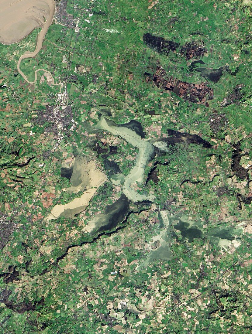
| Flooded Somerset levels. Satellite image of the flooded Somerset Levels,Somerset,UK. At top left the River Parrett opens into the Bristol Channel. This area,which is only metres above sea level,is former marshland that has been drained and reclaimed for agriculture. Heavy rainfall from December 2013 to February 2014 caused severe flooding. Image obtained by the Advanced Land Imager (ALI) on the Earth-Observing-1 satellite satellite on 16th February 2014 | |
| Lizenzart: | Lizenzpflichtig |
| Credit: | Science Photo Library / NASA |
| Bildgröße: | 2835 px × 3762 px |
| Modell-Rechte: | nicht erforderlich |
| Eigentums-Rechte: | nicht erforderlich |
| Restrictions: | - |
Preise für dieses Bild ab 15 €
Universitäten & Organisationen
(Informationsmaterial Digital, Informationsmaterial Print, Lehrmaterial Digital etc.)
ab 15 €
Redaktionell
(Bücher, Bücher: Sach- und Fachliteratur, Digitale Medien (redaktionell) etc.)
ab 30 €
Werbung
(Anzeigen, Aussenwerbung, Digitale Medien, Fernsehwerbung, Karten, Werbemittel, Zeitschriften etc.)
ab 55 €
Handelsprodukte
(bedruckte Textilie, Kalender, Postkarte, Grußkarte, Verpackung etc.)
ab 75 €
Pauschalpreise
Rechtepakete für die unbeschränkte Bildnutzung in Print oder Online
ab 495 €
Keywords
- 2000er Jahre,
- 21. Jahrhundert,
- Ackerland,
- britisch,
- England,
- Englisch,
- eo-1,
- Erdbeobachtung,
- Europa,
- europäisch,
- Fluss,
- Flut,
- geografisch,
- Geographie,
- Großbritannien,
- ländlich,
- Landschaft,
- Mündung,
- Nässe,
- Naturkatastrophe,
- Satellit,
- Satellitenbild,
- Somerset,
- überflutet,
- Überschwemmung,
- Vereinigtes Königreich,
- Wasser