Ptolemaic map of British Isles
Bildnummer 11674632
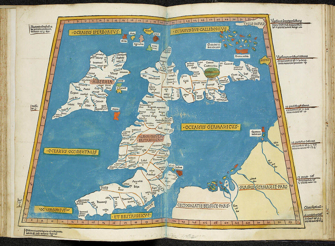
| Ptolemaic map of the British Isles. This map was reproduced in the 15th Century based on the works of the Roman scholar Claudius Ptolemy. His book,Geographia (also known as Cosmographia),printed in the 2nd Century,outlined geographical locations and provided instructions for map making. The map lists classical latin names for locations such as Hibernia (Ireland),Albion (Britain),and Caledonia (Scotland) which,according to Ptolemy's coordinates,appears misaligned | |
| Lizenzart: | Lizenzpflichtig |
| Credit: | Science Photo Library / British Library |
| Bildgröße: | 4884 px × 3578 px |
| Modell-Rechte: | nicht erforderlich |
| Eigentums-Rechte: | nicht erforderlich |
| Restrictions: | - |
Preise für dieses Bild ab 15 €
Universitäten & Organisationen
(Informationsmaterial Digital, Informationsmaterial Print, Lehrmaterial Digital etc.)
ab 15 €
Redaktionell
(Bücher, Bücher: Sach- und Fachliteratur, Digitale Medien (redaktionell) etc.)
ab 30 €
Werbung
(Anzeigen, Aussenwerbung, Digitale Medien, Fernsehwerbung, Karten, Werbemittel, Zeitschriften etc.)
ab 55 €
Handelsprodukte
(bedruckte Textilie, Kalender, Postkarte, Grußkarte, Verpackung etc.)
ab 75 €
Pauschalpreise
Rechtepakete für die unbeschränkte Bildnutzung in Print oder Online
ab 495 €