Cities of London and Westminster,a map
Bildnummer 11674474
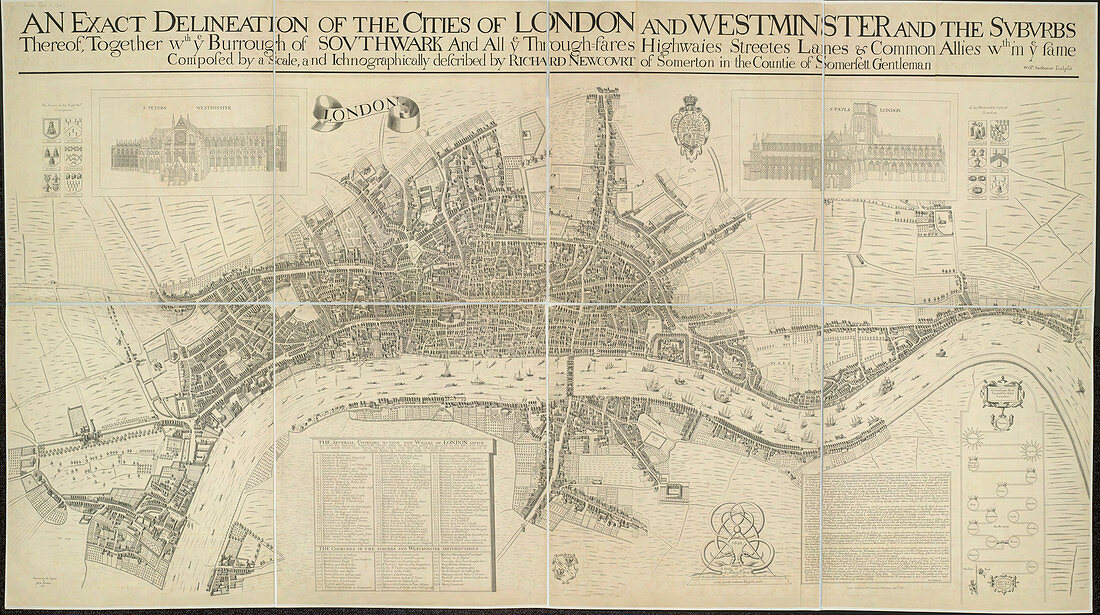
| A map of the Cities of London and Westminster,An exact delineation of the Cities of London and Westminster and the suburbs thereof,together wth. ye Burrough of Southwark. This is a copy of the 1658 Faithorne map made in 1857. It depicts London as it stood during the last two years of the Commonwealth,before the great fire. Dense clusters of houses appear very close together,separated only by narrow streets - an indication of the city's vulnerability to fire. Illustrated by Richard Newcourt | |
| Lizenzart: | Lizenzpflichtig |
| Credit: | Science Photo Library / British Library |
| Bildgröße: | 5592 px × 3125 px |
| Modell-Rechte: | nicht erforderlich |
| Eigentums-Rechte: | nicht erforderlich |
| Restrictions: | - |
Preise für dieses Bild ab 15 €
Universitäten & Organisationen
(Informationsmaterial Digital, Informationsmaterial Print, Lehrmaterial Digital etc.)
ab 15 €
Redaktionell
(Bücher, Bücher: Sach- und Fachliteratur, Digitale Medien (redaktionell) etc.)
ab 30 €
Werbung
(Anzeigen, Aussenwerbung, Digitale Medien, Fernsehwerbung, Karten, Werbemittel, Zeitschriften etc.)
ab 55 €
Handelsprodukte
(bedruckte Textilie, Kalender, Postkarte, Grußkarte, Verpackung etc.)
ab 75 €
Pauschalpreise
Rechtepakete für die unbeschränkte Bildnutzung in Print oder Online
ab 495 €